
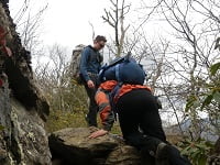
In 2010, my buddy, Coop, and I met Chris, a fellow backpacker, at the base of Shining Rock in North Carolina. At the time, Chris had just turned back due to extreme winter conditions, and we were looking for a place to camp before the sky went dark and we froze to death. After surviving the night, the three of us exchanged contact information and suggested we get together again in the future.
This past weekend, almost two years later, the three of us realized the suggestion. Coop and I started at Sam Knob via the Flat Laurel Creek trail off of NC Highway 215/Lake Logan Road on Friday, ran an impromptu 5K to the top of Sam Knob’s 6,055′ peak, and Chris joined us on Saturday morning at the Black Balsam Road parking lot en route to Cold Mountain.
DAY ONE

The Flat Laurel Creek trailhead is off NC Hwy 215 0.8 miles north of the intersection of 215 and the Blue Ridge Parkway. Going north on 215 from the Parkway there is an unmarked gravel road to the right. We parked at the end of the road, geared up, and started walking.
After crossing the creek, the next 2.5 miles was a gentle 600′ climb to the junction of Sam Knob Trail. We hung a left, made our way to the base of Sam Knob, and headed east about 300 yards where we set up camp in an open field just below the tree line. A
Before it got too late, we changed clothes and took off for a 5K. The first portion of the loop was a breeze as it was mostly downhill with plenty of technical elements (e.g. rocks, creeks, mud, ice). At the Sam Knob trailhead (where it crosses Flat Laurel Creek) we started the 1-mile ascent to the top. Within a 0.25 miles I was winded. With 0.5 miles to go I was mixing it up with a bit ‘o walking with jogging. By the time we reached the top we were just glad to be breathing.
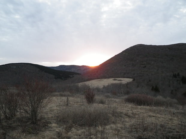
At the top, Sam Knob is mostly treeless with a sweet 360-degree view of Black Balsam Knob, Devil’s Courthouse, Tennent Mountain, Shining Rock, Mt. Pisgah, Mt. Hardy, Max Patch Mountain, Cold Mountain, and Mt. Mitchell, to name a few. We snapped a few photos and ran back down to our campsite just before the sun went down.
DAY TWO
Around 6:30AM we broke camp in preparation for Chris’ 7AM arrival. An hour passed. Then another. No sign of Chris. Since we knew he’d be coming from the direction we were headed, we opted to start hiking with the hopes of meeting up with him on the trail. As luck would have it, we ran into him just a half mile from our campsite at the Black Balsam Road parking lot where Flat Laurel Creek, Ivestor Gap, and Art Loeb trails intersect. Perfect timing.
To get to Cold Mountain we had two options: A) Ivestor Gap Trail, the easy road, or B) Art Loeb Trail, the high road. We went with option B.
After the initial 20-minute climb to the top of Black Balsam (6,214′) we continued down through a saddle, made our way up to Tennent Mountain (6,040′), and eventually found ourselves at Grassy Cove Top (6,055′).
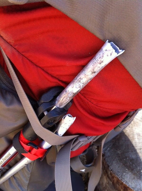
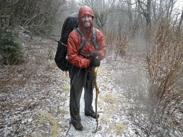
The day was dandy. Everything was going great. Then, on the way down the backside of Grassy Cove Top, my trekking pole flat out snapped as I planted it into the muddy ground. The three of us stared and laughed, and then I stopped laughing long enough to fashion a replacement from a fallen branch.
We followed Shining Rock Ledge across Flower Gap and Flower Knob until we reached a clearing at Shining Rock (6,010′) where Coop and I had built a snowman two years prior.
If you’re thinking you might want to retrace our steps then you should pay attention because this part is tricky. As you hike north on Art Loeb towards Shining Rock the trail breaks off into several different paths. If you go straight/north through the grassy clearing you’ll end up at the actual Shining Rock (which is a nice lunch spot, but a horrible way to get to Cold Mountain). If you go straight/north and veer to the right you’ll end up on Old Butt Knob. If you go to the left/west you’ll hit an Ivestor Gap spur (aka Little East Fork Trail). What you need to do is walk around the grassy clearing to the left/northwest. When you do, go past the trail through the pine trees, down a couple of log steps, and the trail to Cold Mountain will be right in front of you.
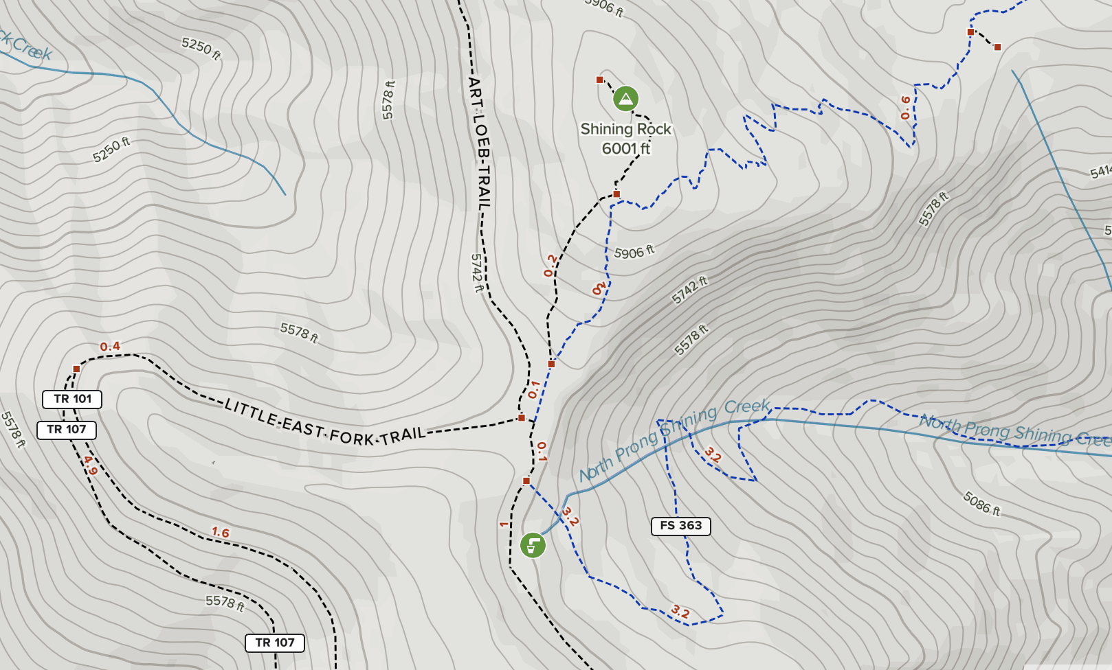
Once on the correct trail we walked a 0.1 miles over a very rocky path and stopped just shy of Stairs Mountain (~4 hours from the Black Balsam Road parking lot).
Stairs Mountain is a rough and technical section with plenty of rocks to navigate and trees to duck under and climb over. Eventually the trail narrows to become, wait for it…The Narrows. People often complain about this section, but it’s not that bad. Just stay on the path and don’t fall off.
From The Narrows we descended to Deep Gap where we came across the second of three groups of hikers we saw over our three-day trip. We exchanged greetings then abandoned Art Loeb (which turns sharply to the southwest) in favor of the Cold Mountain Spur trail which runs northwest.
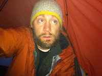
Forget Art Loeb’s Stairs and Narrows sections, this trail is the worst. It’s a 1.5 miles of relentless climbing all the way to the top of Cold Mountain (6,030′). About three quarters of the way up we stopped and refilled water at a piped in source (a literal PVC pipe stuck into the side of the mountain). Two hundred yards later (and 7 hours, 10+ miles on the day) we picked a campsite.
With my butt firmly planted on a fallen log, I Skyped with my toddler son and watched him dance around the dining room saying “Dada.” A fantastic way to cap off the day.
DAY THREE
NOAA called for a 100% chance of rain. They were 100% correct. It rained from 8PM the night before and followed us all the way home. But it wasn’t just any old rain. The sky was shooting shards of glass sideways at 30MPH into the side of our faces for the first 1.5 hours as we went down Cold Mountain, through Deep Gap, up The Narrows, and over Stairs.
At Shining Rock the weather switched to a slightly more moderate rain with a bit of sleet mixed in, and we bypassed Art Loeb in favor of the much faster Ivestor Gap alternative.
This long winding logging road cut out the ups and downs of Grassy Cove Top, Flower Gap, and Flower Knob, but it ascends at a 2% or 3% grade the entire 3.7 miles from Shining Rock Gap to the Black Balsam Road parking lot.
Once we reached the BBR parking lot I knew all I had to do was force myself downhill for a little over an hour. Step by speed-walking step I trounced over rocks, through mud, and on ice as I made my way down Flat Laurel Creek trail.
As we descended the final 800′ to the parking lot, the weather flip-flopped from rain to sleet to snow and back to rain. Then, we arrive, five hours and change after breaking camp at Cold Mountain.
Trip complete.