In October 2014, Coop and I planned an ambitious 20-mile hike with nearly 10,000′ of elevation gain through the Three Ridges and Priest Wildernesses. Ambitious because, at the time, I was two months out of shoulder surgery and I hadn’t been particularly active. Still, like my third helping at Thanksgiving, the trip seemed doable.
As the story goes, we hiked 3.2 miles along Mau-Har trail and another 11 miles over Three Ridges until returning to the parking lot at Crabtree. Then my wheels fell off, and we ended up camping about a half mile up the trail. That night, Coop vowed a return trip to finish what we started.
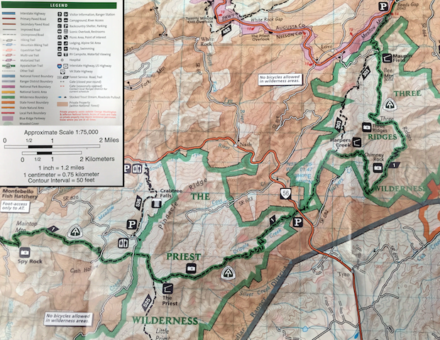
Flash forward a year and a half to a time between new babies and tee-ball practice. Coop asked me if I wanted to give The Priest another go. I agreed and he followed up with a plan that would take us up and over The Priest and onto Spy Rock. We’d spend the night near Spy Rock and hike back down the next day. In total, according to hillmap.com, we’d knock out 14.5 miles with ~5,000′ of elevation gain and loss. Perfect.
PACKING IT IN
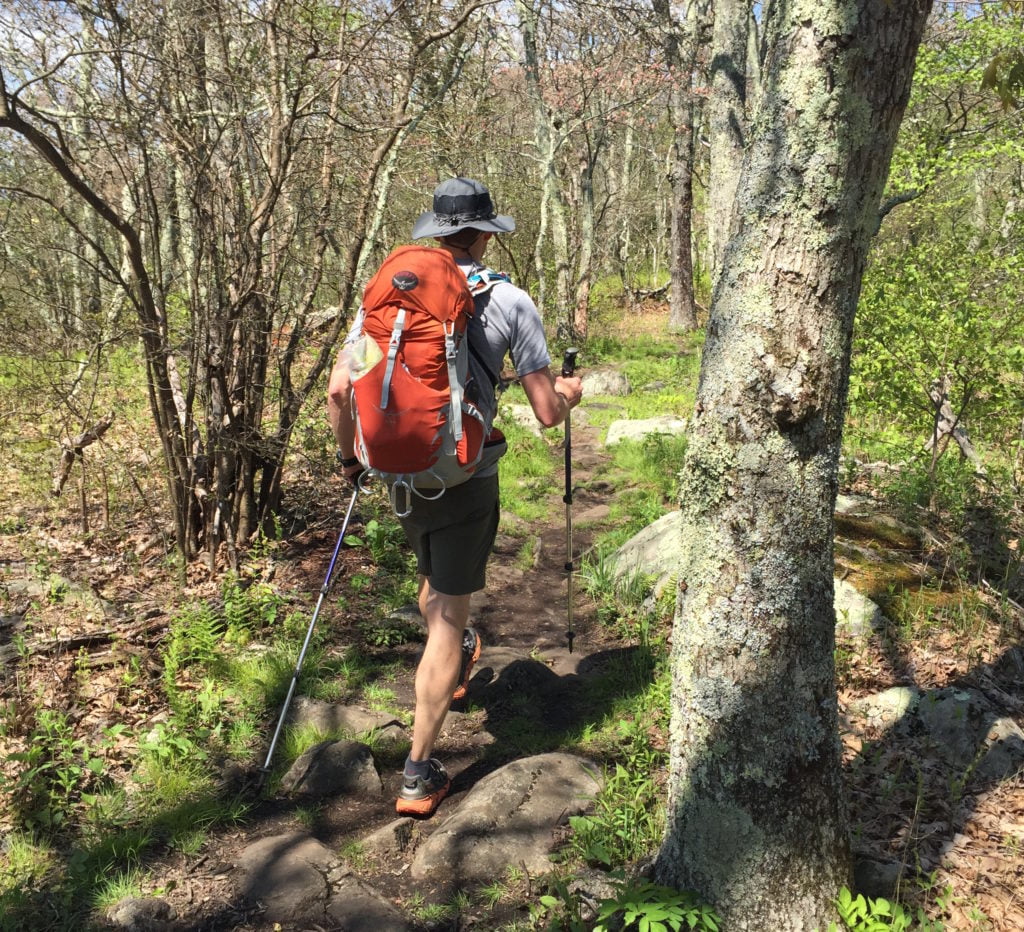
Since we were only going on an overnight I wanted to make adjustments to my gear that would accommodate a lighter load on my back and feet. First, I used my Osprey Stratos 34L daypack; a 14L downsize from my Osprey Kestrel. Getting my usual gear into a significantly smaller space was a challenge especially since I tend to carry the must haves and the nice to haves. After multiple attempts at packing and repacking I was able to get my pack, including water, down to 24 pounds—8 pounds less than my usual pack weight. To put it another way, I essentially removed the equivalent of a gallon of milk from my pack. The second adjustment was to footwear. I ditched my bulky Asolo boots for a pair of Brooks PureGrit 2 trail running shoes, medium weight socks, and running gaiters.
SCRATCHING AN ITCH
A week and a half before the trip, after yard work, a trail run, a dayhike, or perhaps playing with my dog, I came in contact with toxicodendron radicans aka poison ivy. At first, the rash appeared on my face in a line stretching from my eye down to my chin. A few days later, the rash appeared on my neck, arms, and legs. Then, after a day of itchy tremors, the red patches erupted into a ring of fire; volcanoes of bubbling blisters spewing yellow ooze from every opening. Being no stranger to poison ivy I made a trip to the doctor for a steroid shot, prednisone, and a tube of triamcinolone acetonide. Six days later, on the day I was to leave, my rash had calmed to a point that I figured could be managed from the trail.
DAY 1 (9.64 MI | +4,377′ GAIN | -1,594′ LOSS)
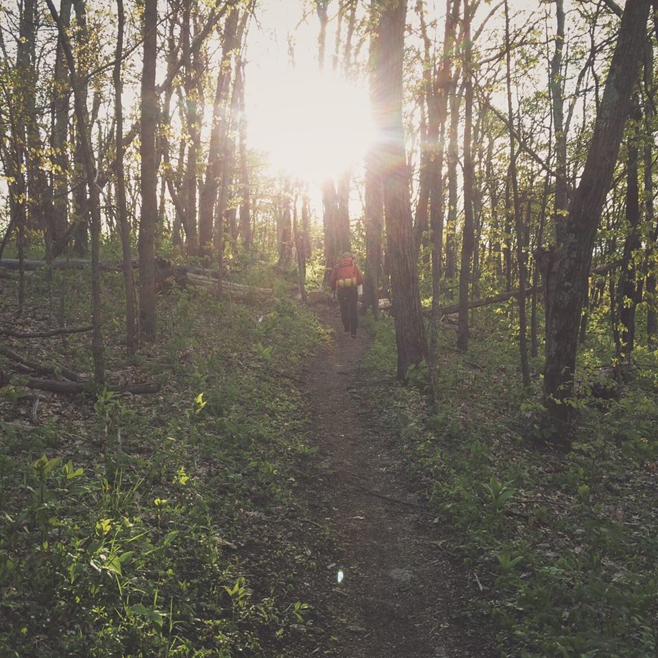
From the parking lot off VA Route 56 just past Tyro, VA (37.838259, -79.022341) we headed west on the AT into the Priest Wilderness and began the 4 mile, 3,200′ climb to the top of The Priest. It was chilly, around 48ºF with ~10 MPH winds. With the sun shining, we opted to stick with shorts and a T-shirt. After all, as Coop said, it was perfect hiking weather.
A half mile in we came across an older thru-hiker moving slowly. On approach we could hear him exhaling with every step. His pack was bulging and had all kinds of luxuries strapped to the outside. He looked hot and uncomfortable. Long pants, rain coat, winter hat, and big sturdy boots. We exchanged greetings as we passed him. “Show offs,” he muttered. I half-laughed as I replied, “Nah. Just fresh legs.”
Another half mile later, 24 minutes after we started, we completed the first 832′ climb and our first mile. A short time later, we crossed a flowing creek and passed a second hiker who was coming down the mountain. His face, wrapped by the hood of his jacket, looked concerned. Not for him, but for us.
My watch chimed letting me know that we logged our second mile and climbed 730′ in just over 21 minutes. Pressing forward, I curved around a sharp switchback and was greeted by a strong gust of wind. BANG! An enormous branch broke free from its trunk. I looked up, startled by the thought that the rest of the tree would follow. Thankfully, it did not. Then again the wind gusted. And again. And again. It was relentless. Each time, it brought with it a chill that edged closer to the freezing mark. I was beginning to question my clothing choices and our initial claim of perfect weather.
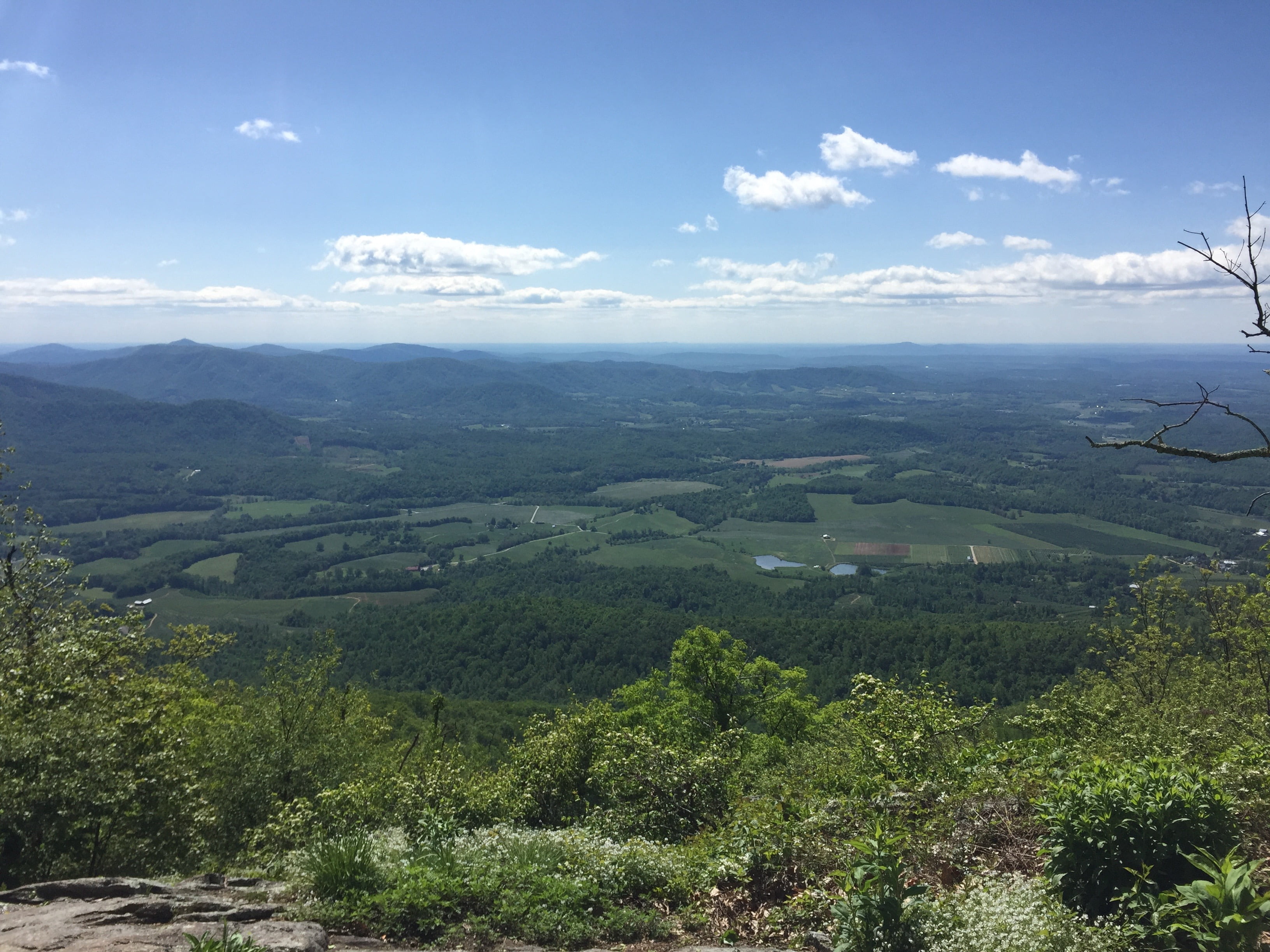
Reprieve came in the form of sunshine and a picturesque view of the mountains to the south. The wind was still howling. The cold, biting. But the warmth of the Sun’s golden rays and the breathtaking view helped me forget if only for a moment. And then my memory returned.
Packs on and feet to the ground, we waved howdy-do to a half-dozen hikers before finishing the third mile and another 924′ of elevation gain. Legs good. Back good. Thirty minutes more and we had climbed the remaining 685′ to the 4 mile mark to the summit of The Priest. Well, I think it was the summit. There wasn’t a survey marker anywhere to be found, but the trail had switched from gain to loss so I’m calling it the summit.
We took in the views from the outcroppings just off the trail, and commented on our seemingly abundant energy, our quick pace, and the cold. We definitely talked about the cold. The blowing, never-ending, ridiculously cold May wind.

Back on the trail we passed The Priest shelter trail, hung a right, passed a couple of thru-hikers looking for the shelter, and made our way down to an information station just shy of the fire road leading to Crabtree Falls. The sign suggested we had another 3.5 miles to go before we got to Spy Rock. This was contradictory to the Hillmap route Coop put together that suggested we only had 2 miles. The difference, as we would quickly figure out, was in the switchbacks. While Hillmap is a useful tool, it isn’t 100% accurate unless you’re completely zoomed in and marking every twist and turn.
Our main concern with the additional 1.5 miles was not the distance, but the water. Between The Priest shelter and Spy Rock there is no water source. Would I be good with 1 1/2 Nalgene bottles of water, or should we go back up the mountain to the shelter and fill up our reserve bladders? OK, perhaps the real question is, do we really want to hike back up The Priest? No. We didn’t. So we decided we’d be fine and moved on.
At the fire road we passed two more hikers then returned to the trail through a tall section of poison ivy lined weeds. Dear God! If I end up with another Toxic Avenger rash I may lose my mind. While I’m on the topic, my existing rash wasn’t all that bad. It itched occasionally, but was completely tolerable.
We walked a few miles, passed some day hikers, and came across a quaint little campsite with room for two and a fire ring between two giant stones. We made note of its location and hiked the remaining half mile to Spy Rock. At its base there was a huge grassy area with thin tree cover where the wind blew across with great intensity.
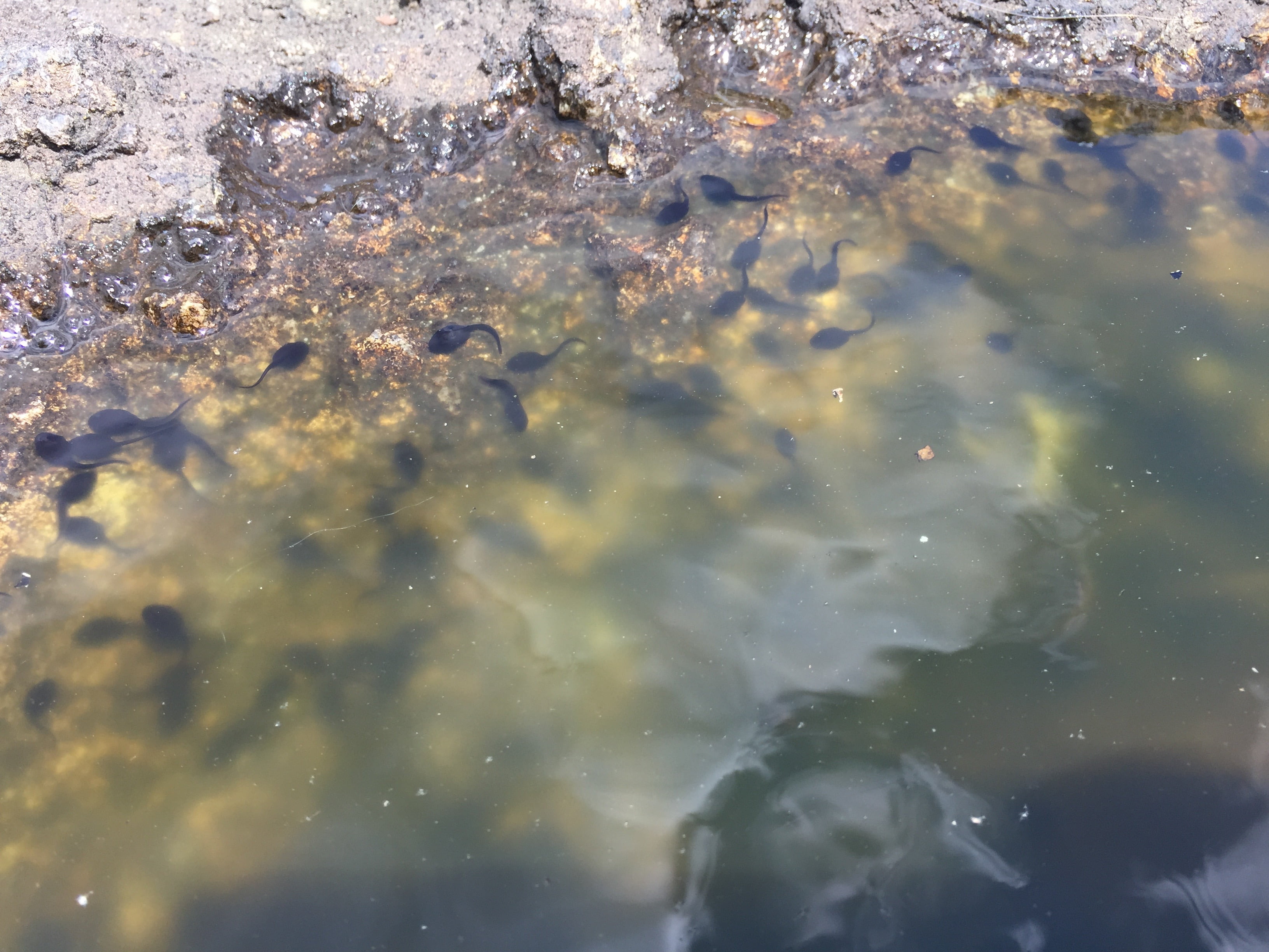
The spur trail to the top of Spy Rock split into two directions. To the right it went down and disappeared along the backside. I can’t say for sure if it wrapped back up to the top because we opted for the route to the left. This trail wound around the base, through rhododendrons, up boulders, and eventually to the rocky face of Spy Rock. The views, like the others we’d seen earlier in the day, were fantastic. Then something caught my eye.
In the rock face, pockets of rain water collected in holes worn away by time. In the water, tadpoles. Hundreds of little tailed fellas in each of the 30+ divots. A strange place for tadpoles I thought. Cue Jeff Goldblum, “Life finds a way.”
We hung out for a bit, were joined by a handful of other folks who appeared to come up from the fish hatchery, and then headed back down to set up camp. At the base we walked around for a site that would provide cover from the wind. Of the three or four sites, none of them would suffice. Instead, we decided to head back a half mile to the spot we’d seen earlier.
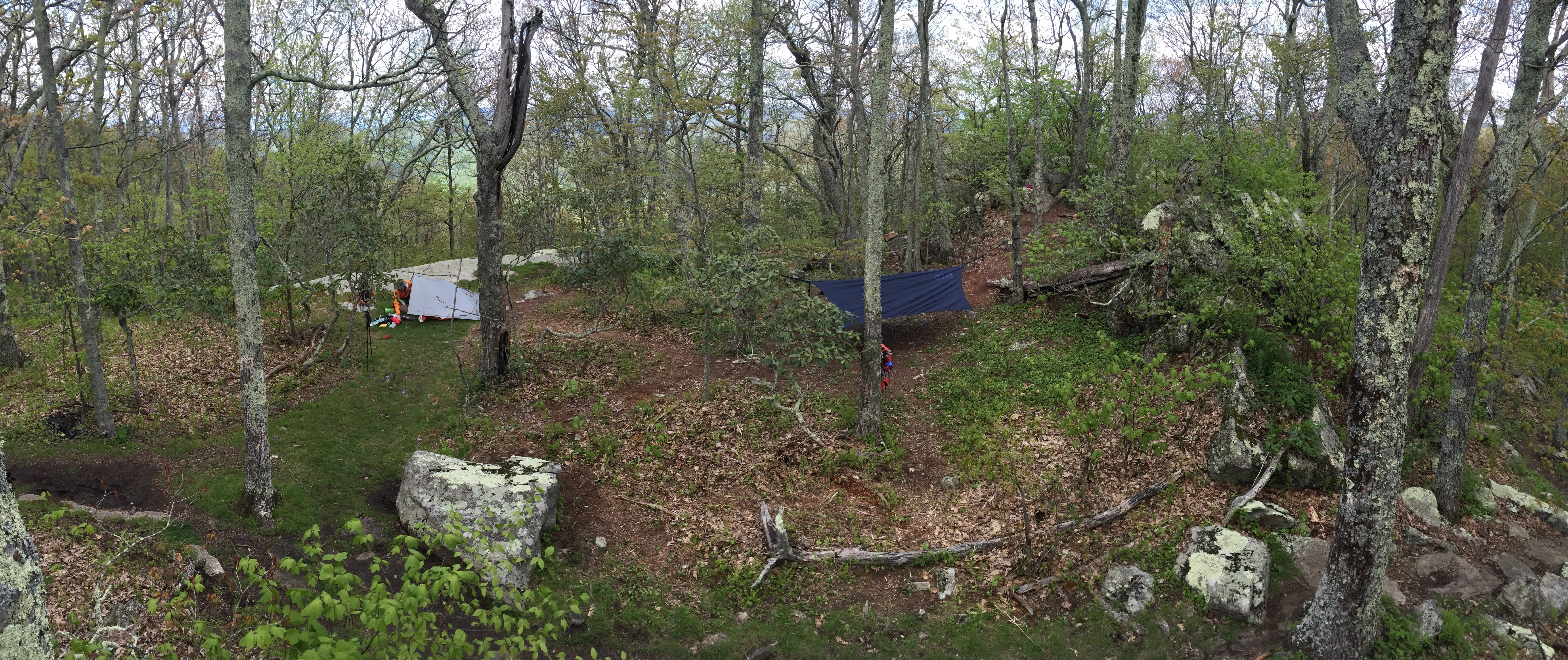
At our new home for the night, I hung my hammock, Coop set up his tarp, and then we began doing the things you do when you set up camp.
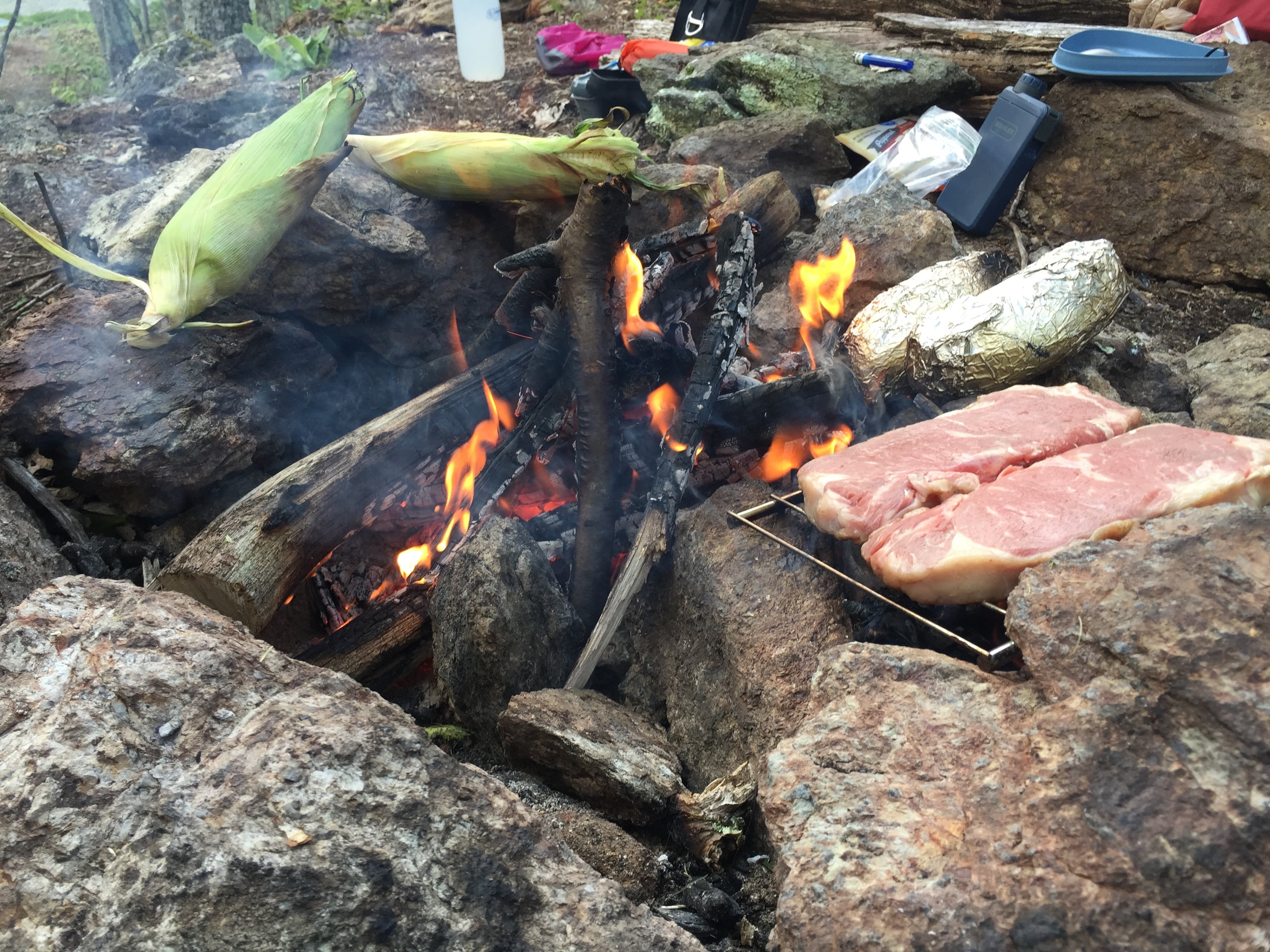
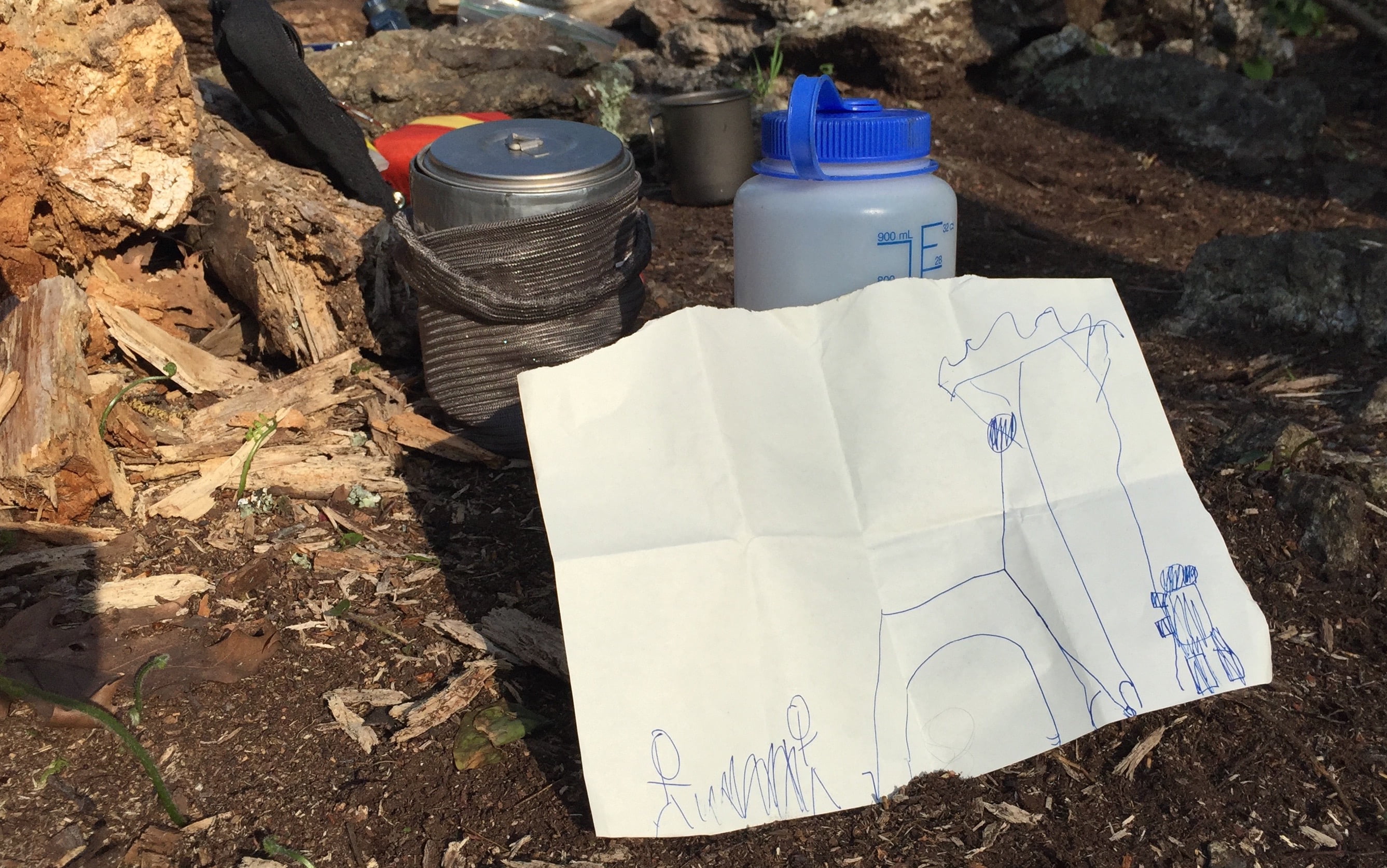
With Coop’s fire roaring we cooked steaks, potatoes, and corn. There’s nothing like a good non-dehydrated meal after a long hike. We stuffed our gourds, relaxed, and with my 5YO son’s drawing in hand, scoped out a tree to hang a bear bag.
Back at the fire, we turned on Caveman TV, smoked cigars, talked, and waited for the stars to come out. Jupiter was shining bright and was clearly making the moon uncomfortable.
Then we saw him. The first hiker from 8 hours ago. “Is this the world famous Spy Rock?” he asked Coop as he approached our campsite. “No,” Coop said. “You’ve got another half mile.” Clearly disappointed, the dude went on to say that he was hiking to the next shelter, Seeley-Woodworth Shelter, another 3 miles from our site. At his current rate he’d be walking in the dark for at least half the trip.
Just before 10PM, thanks to a surprisingly strong cellular connection, I checked the overnight forecast. “Well that’s odd,” I thought. “A red exclamation point inside a red triangle. That can’t be good. Let’s see here. A frost advisory?” I went on to read that temperatures would settle in the low to mid 30s and winds would be a constant 8 MPH with gusts up to 15 MPH. With windchill factored in the temperature would feel well below freezing. Good thing I wasn’t prepared.
I went through a mental inventory of my pack. It didn’t take long before Pride spoke up boasting of the pre-trip 20-pound packing accomplishment. Shut your face Pride! Now is no time for bragging. I joked with Coop that I’d be wearing my extra socks on my hands and spare underwear on my head. We laughed. Thirty minutes later, I was settling into my hammock putting socks on my hands and underwear on my head.
By 10:45PM I was asleep. By 11PM I was not. Thank you sound in the distance. Bear? Coyote? Puma? No, a hiker was coming down the trail blazing a 1,000 lumen headlamp that lit up my rainfly like the backdrop of a shadow puppet show. Thankfully, he didn’t stop to murder us, and I was able to fall back asleep. I’m sort of glad the hiker didn’t stick around. I’m not really good at shadow puppets. I can probably pull off a conversation between two ducks, but that’s about it.
An hour later, my toes woke the rest of me. The wind, which had been blowing against my rainfly, shifted, and was now blowing under my rainfly and over my hammock. It chilled my toes (which were nestled in their socks and under the topquilt) and passed over my exposed nose as it made its way out the other side.
The entire night wasn’t horrible though. In fact, for the most part, my mattress kept my butt from freezing, topquilt did a good job keeping the heat from leaving most of my body, sock gloves kept my hands toasty, and my undies kept my head warm. It was just the shifting cold winds that sucked…really really sucked.
DAY 2 (8.26 MI | +1,253′ GAIN | -4,016′ LOSS)
After a long, restless, chilly night I woke at 5:30AM fully expecting to be sore and unwilling to make the return trip back to the car. Strangely, my body felt great. I grabbed the bear bag, fired up my camp stove, and broke camp. With bag nearly packed, I started my day with tuna and coffee (no oatmeal as I was low on water), walked around a bit, and by 7AM we were back on the trail.
Yesterday, we rocked the trail. We averaged 2.5 MPH going up so I had a feeling we were going to increase the pace on the return trip. For the most part we did. It wasn’t until we reached the backside of The Priest that our pace slowed. It wasn’t horrible, but it wasn’t an escalator either. Eventually we made our way to the shelter’s water source to refill bottles. We were on a roll and I was about to get some much needed hydration.
At the shelter, we came upon a pile of garbage and the contents of the shelter strewn about on the ground. I opted to tidy things up prior to refilling my water. When I did, I discovered that some a-hole had peed in the corner of the shelter. PEED! Not only is there a privy 30 yards away, there’s an abundance of natural urinals in most every direction. I was appalled. Some folks really don’t give a flock of seagulls. PSA: Don’t be an a-hole.
With water replenished we headed back up to the AT to finish the remaining 4.75 miles of our trip. Once we crested the summit it was literally all downhill. We glided down the trail completing the 3,200′ descent in just over an hour and forty minutes. By the time we returned to the car my glutes were on fire and Coop’s knees were spent. We were tired, but we were happy.
FINAL THOUGHTS
This trip was a huge physical and mental success. We returned to conquer The Priest and we destroyed it. I wanted to give my packing skills a shot with a smaller bag and I nailed it. I wanted to see how my feet would hold up in trail runners and it was a huge success. And…AND, I found a penny.