There’s a saying that if you’re backpacking and you don’t like the forecast, wait five minutes and it’ll change. That was certainly the case on a recent backpacking trip I took to the Shining Rock Wilderness with my brother-in-law, Ken. In the 10 days leading up to the trip we watched the wilderness area forecast change daily from hot to cold, sun to rain, and breezy to gale force winds.
In addition to the weather the Shining Rock Wilderness has a couple of rules that impacted our trip. First, no campfires. It’s a rule, and unfortunately many take it as a “rule” including the ones responsible for the recent fire at Cold Mountain that burned 132 acres. Second, in the past few years the bear population has increased resulting in greater than normal bear sightings and bear encounters (one backpacker had a bear enter his tent and remove his backpack). As a result, the U.S. Forest Service requires bear canisters in the Shining Rock Wilderness.
THE PLAN
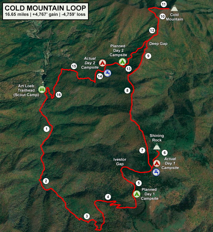
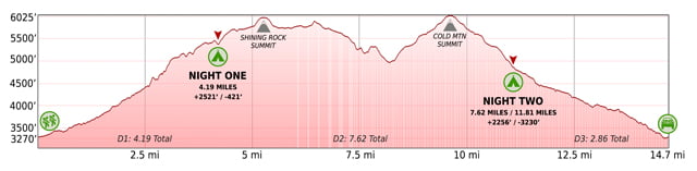
I searched many a website for a good, moderate route before deciding on the Cold Mountain Loop at AllTrails.com; a 14.6 mile hike with 4,570′ of elevation gain. The route starts at the Art Loeb trailhead just inside the Daniel Boone Scout Camp, follows Little East Fork Trail to Ivestor Gap Trail, then it’s Art Loeb all the way back to the car with summits of Shining Rock and Cold Mountain in between.
I’ve hiked the area twice, but refreshed my memory reading recent trail reports and reviewing the NatGeo Pisgah Ranger District map (#780). I made note of the potential campsite locations…
…created an elevation profile using Google Earth
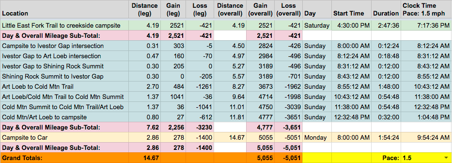
…built out the trip plan as a spreadsheet with estimated leg times based on a 1.5 MPH pace
…and packaged it all in a nice little map I then printed on TerraSlate paper.
PACKING IT IN
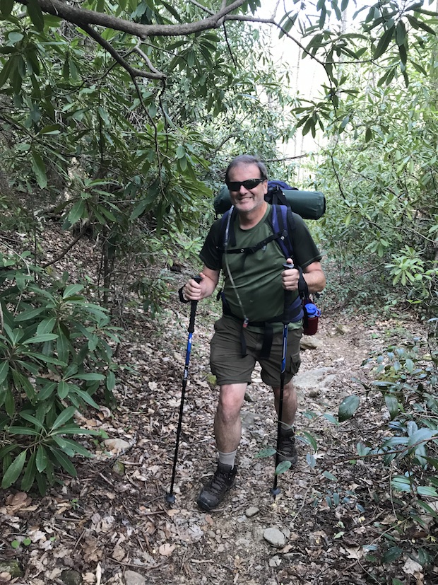
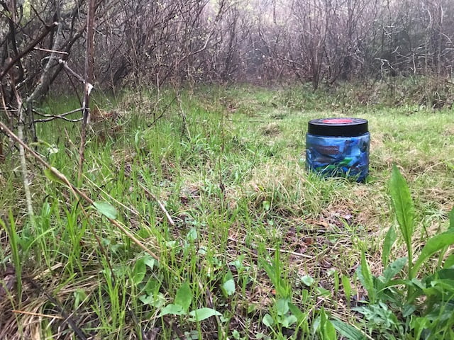
In light of the forecast, I teetered between tent and hammock. A tent would provide good coverage and be the obvious safe bet. A hammock would leave me open to the elements, but would be fun. I sided with fun and coupled the hammock with my largest rain tarp. The bear can was a new one as I’m used to hanging a dry bag from a tree. To meet the Forest Service’s requirement I purchased a BearVault BV450 which weighs 2 pounds 1 oz empty (and 6 pounds with food and toiletries). The last item of consideration was footwear. I recently started favoring trail runners over hiking boots for three-season adventures. I was anxious about wearing trail runners given the amount of rain in the forecast, but finally decided on using ’em. Once packed, my Atmos AG 50L weighed in at 31 pounds 2.7 ounces (including 2 liters of water). FYI, If you’re really interested/bored, you can download the complete list of things I brought with me on this trip.
DAY 1 (5.85 MI | +2,593′ GAIN | -94′ LOSS)
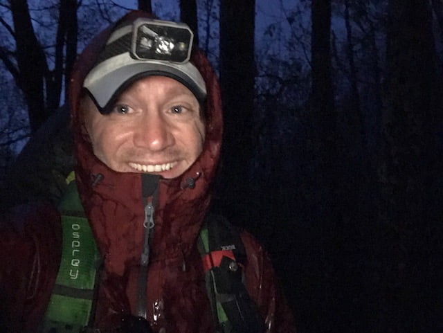
We arrived at Daniel Boone Scout Camp around 4:15PM, parked across from the Art Loeb trailhead, and began to gear up. As we did, something was off. The sky wasn’t dark, it wasn’t cold, the wind wasn’t blowing, and it wasn’t raining. In fact, the sun was shining and I was starting to perspire.
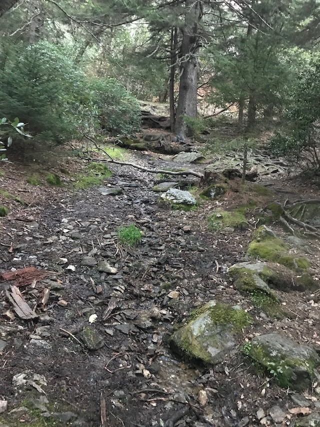
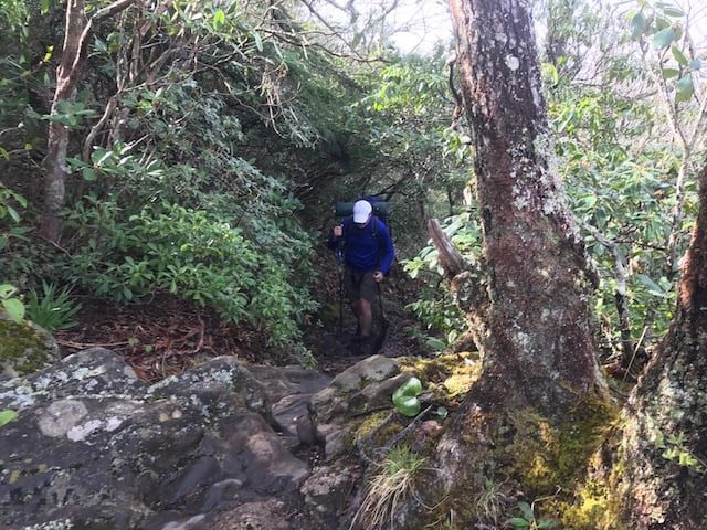
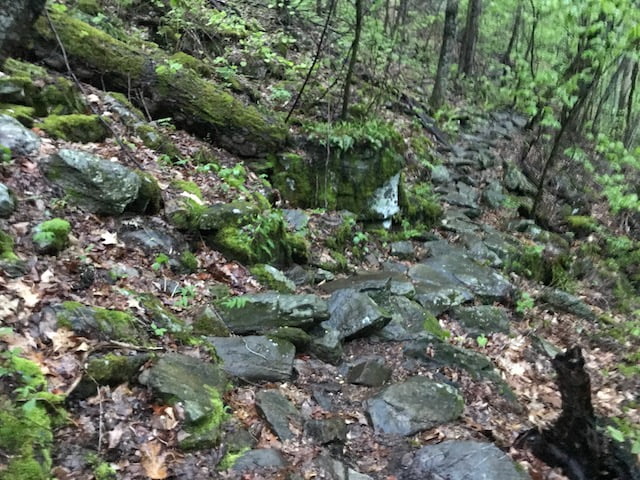
From the car we hiked up the road, crossed a bridge, and walked by the scout cabins before hitting the Little East Fork trailhead about a quarter mile from the car. For the next couple miles the trail was much of the same. On the right, trees. On the left, creek. Up ahead, incline.
Just shy of 3 miles we crossed Shining Rock Creek using large boulders and a downed tree. On the other side the trail was a short, steep, and rocky climb that ran NNE and perpendicular to the creek.
We hiked a bit more before taking a breather at an old campsite. We were ahead of schedule and cruising at 2.5 MPH. If we continued at this pace we’d be at our first night’s campsite a full hour ahead of schedule. For the next half mile we followed the trail east, then north, then northwest, then east again before hitting the first of three switchbacks just past mile 4.
That’s when I started to question the mileage on the All Trails map. Their route said we’d hit the switchbacks 3.25 miles in. Clearly that was not the case. We pushed through the switchbacks, continued east after the last one, and turned sharply to the north at the 4.5 mile mark. After glancing at both my Garmin map and my paper map I determined we’d be hitting our creekside campsite in about a quarter mile.
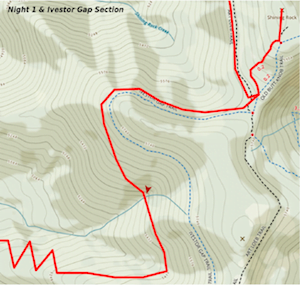
We kept our eyes and ears open. A quarter mile came and went. Then another. There were no signs of a creek, flowing or otherwise. There were, however, signs of water in the form of rain. It was only a sprinkle, but the clouds were moving in from the south and the wind was picking up. With our planned destination a bust, we really needed to find a campsite. On the map it appeared that Ivestor Gap Trail was around the corner which meant Shining Rock Gap couldn’t be more than a quarter mile from there. We moved sans haste.
Just past Ivestor Gap Trail we spotted a hiker coming down the trail. He didn’t have a pack. At first I thought he was an overzealous birdwatcher about to get hit by the storm on his way back down the mountain. Then I realized he wasn’t headed back down, he was gathering wood. That meant he was camping nearby which meant we would be camping nearby. I was pleased. Smokey was not.
We passed the birdwatcher, exchanged greetings, and continued on to the most confusing intersection in all of the Shining Rock Wilderness—Shining Rock Gap. The intersection splits into not one, not two, not three, not four, not five, but six directions: Shining Rock Summit Trail to the northeast, Old Butt Knob Trail to the east, Shining Rock Creek Trail to the southeast, Art Loeb Trail to the northwest and south, and Ivestor Gap Trail to the west. Seriously, unless you’ve been here or have a compass you will probably end up somewhere you don’t want to be.
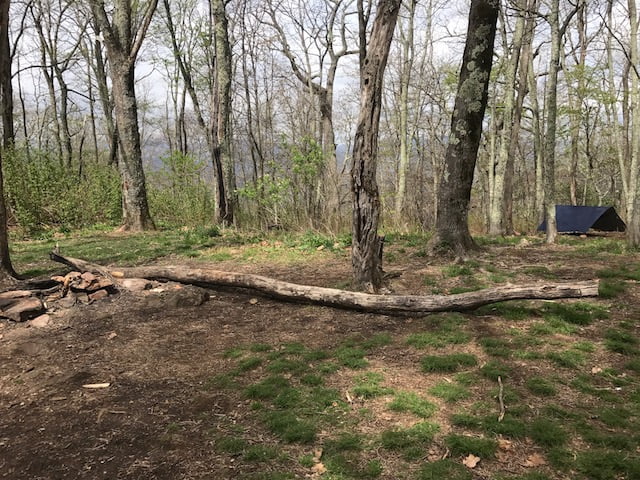
When we arrived at the gap there were two groups camped on the left and right side of the Shining Rock Summit Trail and two others nestled in the trees on the west side of the Art Loeb trail that runs south. Two groups had fires, the other two were law-abiding backpackers.
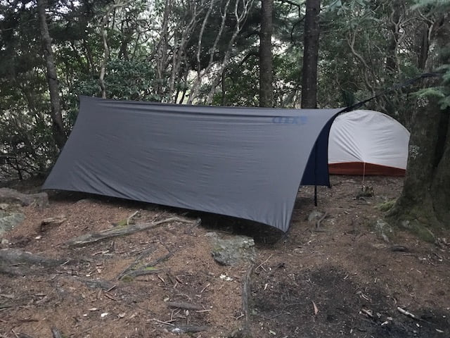
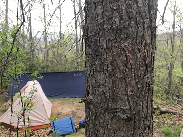
We greeted folks as we searched for a spot; eventually finding one between the two groups off the summit trail. Trees were blowing, clouds were settling, and the rain was a patchy business. I hung and re-hung my hammock on account of the enormous Eno ProFly XL rain tarp, and Ken pitched his shiny new 1-person tent in about 2 minutes.
The rain stopped as I finished so I made an H2O run to a spring just a few minutes down Art Loeb to the south.
I got back, ate dinner, and sat around yucking it up with Ken for a time. Around 10PM I walked the bear can up the summit trail and downwind from the campsite, then made a B-line for my hammock.
DAY 2 (8.07 MI | +1,690′ GAIN | -3,187′ LOSS)
I woke at 7:15AM to the sound of water dripping on my tarp. It wasn’t rain, but droplets from passing cloud that hit the trees as they drifted by. With my raincoat zipped to my nose I grabbed the bear can and returned to break camp before breakfast.
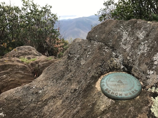
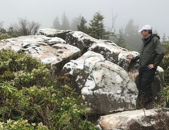
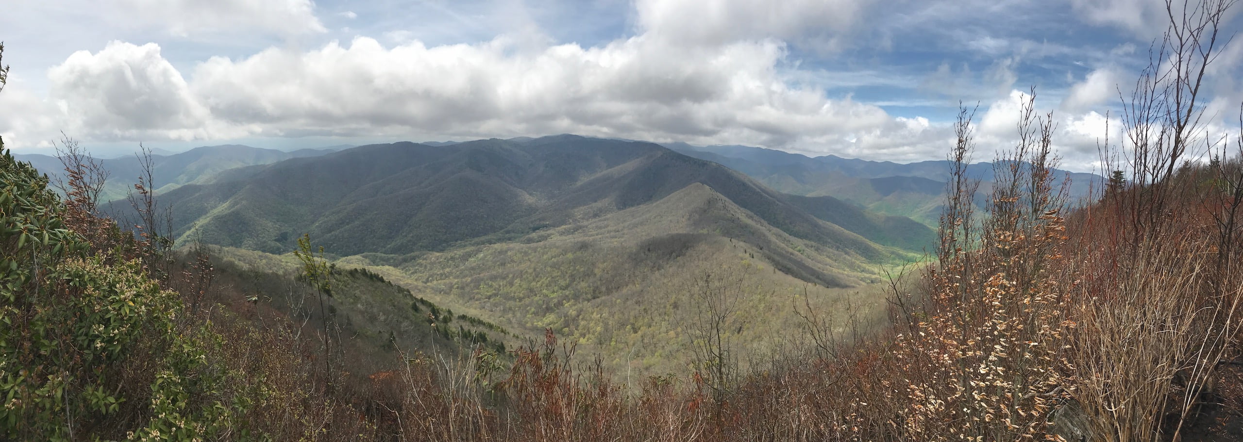
After my hearty oatmeal and tuna breakfast, Ken and I left our packs and hiked to the top of Shining Rock. We announced our arrival with a yodel and the clouds made way to provide a brief moment of clarity to the north and west.
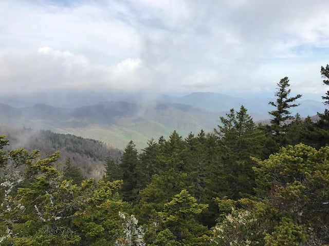
Back at camp I was able to get a signal so I checked the forecast. Surprise, surprise. It changed, again. As of that very specific moment in the space-time continuum, the day was to be clear and warm with a slight chance of a passing storm around midnight. Tomorrow morning, however, was to be stormy with gale force winds in excess of 50MPH.
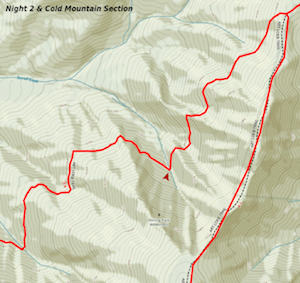
Coincidentally, just a few minutes later, a dude approached us looking for the 36-hour forecast. He and his buddy were planning on leaving their stuff at Shining Rock, dayhiking out-and-back to Cold Mountain, and heading home via Art Loeb in the morning. I shared what I knew, wished him luck, and we took off down Art Loeb towards Deep Gap.
The 2.7 mile hike from Shining Rock Gap to Deep Gap is mostly flat and downhill with the exception of Stairs Mountain. It’s not a beast, but it has its moments.
Then there are the Narrows. They’re about 2 miles down the trail and live up to their name. From the Narrows we could see Cold Mountain. Before long we came off the ridge just shy of Deep Gap where we passed a lonesome dayhiker and a group of three other hikers with a dog. The dayhiker was on a mission while the group and Fluffy appeared to be lost. Or, maybe they really wanted to take the spur trail to nowhere. What do I know?
A few minutes later we reached Deep Gap and a huge campsite. Rather than hike up Cold Mountain with all our gear we decided to leave our packs behind and take rain gear, snacks, and water. We set up the tarp and hammock in case it rained, left our packs swinging in the wind, and dropped off the bear can downwind. BTW, if you camp at Deep Gap there’s a trail in the back of the campsite that drops down to what I believe (though didn’t confirm) leads to a water source (at least there’s one on the map in that general direction).
Just as we were leaving the dude from the dog group came walking by, stared at Art Loeb, and let out a huge sigh of relief. They were lost, but now they were found. He waved. We waved. We all parted ways.
From Deep Gap we began the 1.37 mile, 1,041′ climb to the summit. Evidence of the forest fire from a few weeks ago was everywhere. About .75 miles up we hit a water source (there’s a PVC pipe stuck in the side of the mountain). I used it when I was on this trail before. Truly a life saver if you camp on Cold Mountain.
With a few hundred yards to go I heard heavy breathing from behind and coming up fast. I stopped, turned around, and was greeted not by Ken running from a bear, but by a shirtless dude running up the mountain. I’d later learn he was simply out for an 11-mile out-and-back from the Art Loeb Trailhead to the top of Cold Mountain. You know. A quick jaunt. No biggie. At the summit, Ken and I took in the views, had a snack, and watched a very unhappy crow struggle against the wind. If crows could swear, this one was a sailor.
On our way out we ran into the weather guy and his buddy from earlier. We exchanged Howdys, and proceeded to the PVC pipe for a quick refill. We made good time back to Deep Gap where we grabbed our gear and took off down Art Loeb for an easy .8 mile hike to our creekside campsite.
On a map, especially when you don’t know where campsites are located, you pick creeks because there are usually places to camp nearby. When we reached the creek there were no established sites or flat ground to make one. We discussed hiking back up to Deep Gap, but neither of us wanted to climb the 600′ of gain required to complete the task. Instead we decided to take our chances at a creek a half mile away. About .4 mile later we found a site at a bend in the trail. Sweet Jesus!
KEN: You what this means don’t you? There’s going to be a better site 10 feet down the trail.
ME: That’s why I’m going to walk down and see.
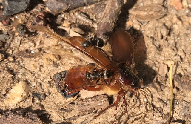
I took off down the trail, crossed the creek, and walked a little more before confirming there were no better sites. Back at camp I looked for a place to hang my hammock. At the base of one tree was an ant hill with some of the most hardcore ants in the entire Pisgah Forest. Tattoos, eye patches, leather jackets, the whole nine. Across from our campsite was a mound of ground bees. A MOUND! And if that weren’t bad enough, I turned from the mound to see a tree with bear claw marks. The campsite trifecta.
We strung a line to dry out gear, played the Appalachian Trail Game, ate an early dinner, and sat around in the hot sun. We counted down the hours then minutes before the sun ducked behind the mountains. Just before dark, I dumped the bear can behind a log on the uphill side of the trail, and prayed that the bears weren’t planning a late night soccer match. If the team showed up I’d be searching for my can at the bottom of a very long and steep hill probably in the dark and most likely in the rain.
I rolled into my hammock just after 8PM and quickly realized I had hung it too low causing my underbelly to drag the ground. If it were to rain, my pack (which was in the underbelly) would get wet. Instead of resetting everything, I reached my hand down and pulled my pack into my hammock. Three hours later it started to storm.
The rain was heavy and the wind sounded like a train as it blew over the mountain and through the trees. I thought about the trees Ken pointed out earlier in the evening. Thought about the big one by the mound of bees. Ran through a scenario where we were pinned down, covered in ants, and hypothermic. Then I went back to bed.
I woke again at 2AM. The droplets sounded like hail. The wind pushed against and around my tarp, rocking my hammock at times. After a few minutes of wondering how the weather dude and his buddy were faring at Shining Rock Gap, I fell back asleep.
At 4:20AM my eyes were open once again and my bladder was screaming. I slipped on my rain pants, and left the comfort of my hammock to answer the call. Soaked, but relieved, I returned to my hammock for a 30-minute nap before waking for the fourth and final time.
DAY 3 (2.72 MI | +484′ GAIN | -1,478′ LOSS)
At 5:30AM I packed everything but my hammock and tarp then braved the elements in search of my bear can. Luckily it was right where I left it and there was much rejoicing. Yaaaaaaaay! Back at camp I made a cold cup of coffee under my hammock and slammed it home before breaking down the last of my stuff. As I did, I saw that Ken was up and packing his things. Ten minutes later, the two of us crammed the last of our water-soaked gear into our packs and headed for the car.
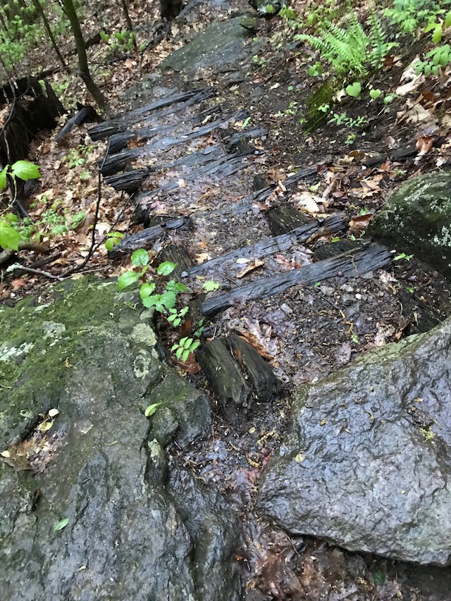
Apart from the million salamanders, slippery rocks, and flight of stairs, the hour and twenty minute hike down was relatively uneventful. And, for the most part, rain wasn’t an issue. It wasn’t until we started packing the car that the sky opened up on us one last time. Thanks nature. I’ll miss you too.
FINAL THOUGHTS
I really enjoyed the Cold Mountain Loop. It’s a tough hike with a good balance of gains and losses. I’m really glad we ditched the packs before hiking to the top of Cold Mountain. And I’m super stoked that I wasn’t murdered by a bear or blown off the mountain while I slept. If I did this trip again I’d probably plan on camping at Shining Rock Gap for the first night and Deep Gap for the second where campsites are established and water sources are close by. All in all it was a good trip.