Mount Rogers National Recreation Area (NRA) spans 191,000 acres in southwestern Virginia within the George Washington and Jefferson National Forests. The area has hundreds of miles of trails including 60 miles of the Appalachian Trail (AT) and boasts the highest peak in Virginia, Mt. Rogers at 5,729′.
I’ve been to the NRA three times: Beartree in Fall 2009, Grayson Highlands in Spring 2011, and Lewis Fork in Winter 2015. Having three of the four seasons covered it only made sense to find my way back for a summer trip.
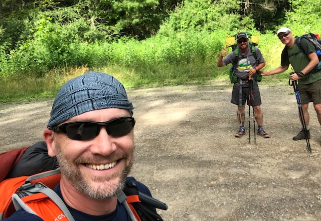
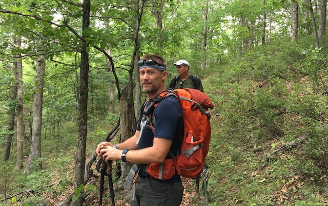
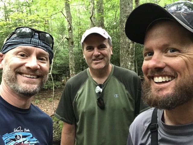
With a general location set, I invited my brother-in-law, Ken, and my running buddy and first time backpacker, John, and started to prepare.
THE PLAN
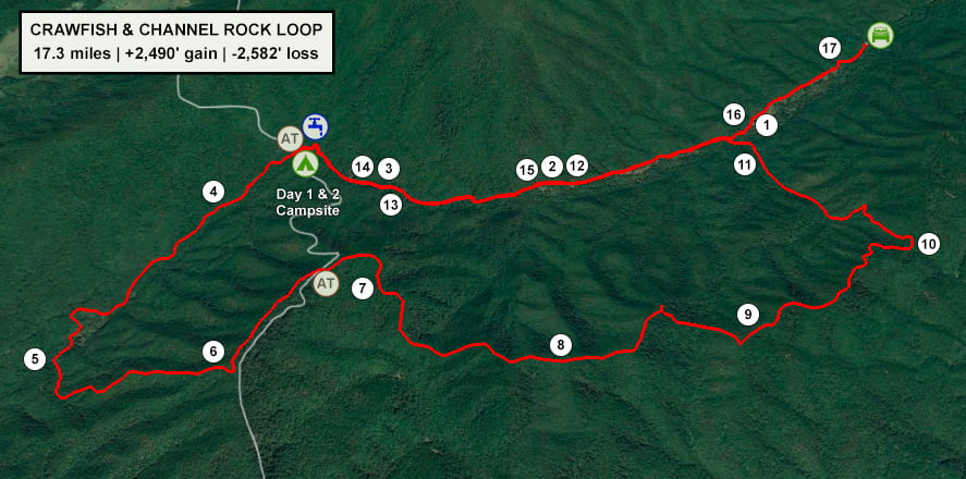
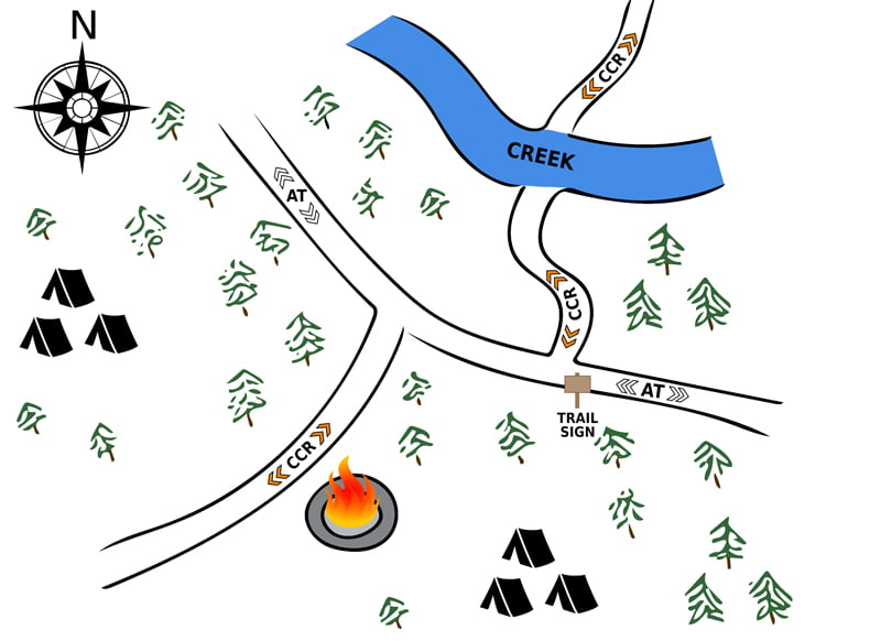
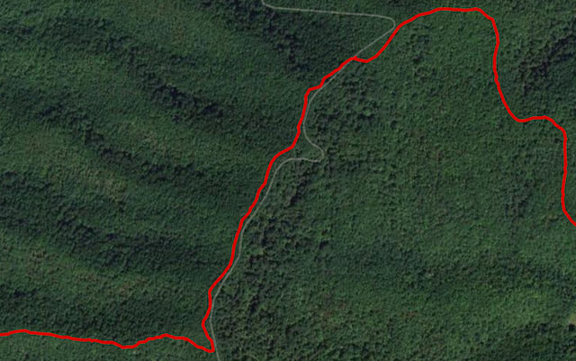
I pulled up HikingProject.com and AllTrails.com, plugged in NRA, and looked for routes near the AT. In theory, if I restricted my search to areas around the AT I’d find a route near a shelter and/or good water sources. Eventually I discovered the Crawfish and Channel Rock (CCR) Loop near Rural Retreat, VA. The route was 15.6 miles with 3,293′ of elevation gain and had plenty of water sources. It looked to be just the kind of trip I was looking for…until I did a little more research.
Combing the trip reports and area information I found another route on AllTrails.com for CCR. This one was shorter, had less elevation gain, and placed the trailhead a mile closer than the other route’s starting location. To dig deeper, I compared the two routes in Google Earth and Hillmap.com.
The longer route seemed to have several straight lines across the contours and traversed through private property whereas the shorter route seemed to follow the contours and stayed within the forest boundary. To be safe, I used the shorter route as my primary plan, and overlaid the two routes on my trip map just in case.
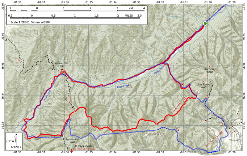
I then picked out potential campsites based on water sources

…created an elevation profile using Google Earth
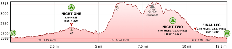
…built out a trip plan as a spreadsheet with estimated leg times based on a 1.5 MPH pace
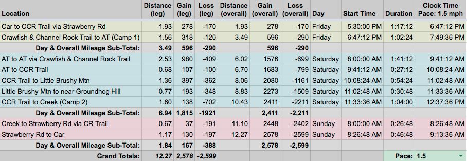
and packaged it all in a map I printed on TerraSlate waterproof/tearproof paper. I also made note of the parking lot I saw on Google Earth and loaded the shorter route’s GPX into my Garmin watch.
PACKING IT IN
Two things factored into my gear selection: John and the weather. It was John’s first ever backpacking trip and he didn’t have a lot of gear so I let him borrow my 50L pack and 1-person tent. That left me with a 34L pack and a hammock. As for the weather, the forecast called for temps between 63°F and 82°F with high humidity and possible thunderstorms on each of the three days. To keep dry I needed to bring a rain jacket, rain pants, and a tarp. To keep the bugs out, I needed the added weight of a bug net and OFF! Deep Woods with 1 fillion percent DEET. On the plus side, since it was going to be rather warm, I was able to shed a few pounds by ditching the topquilt in favor of a bag liner. Because I could, I also threw in my Helinox Chair Zero; a ridiculously lightweight and compact camp chair I’d been dying to use (which was totally awesome BTW).
NERD ALERT! I created a Google Sheet to determine the weight of my pack before packing and used a little trial-and-error to get my pack weight down to 24 pounds 4.1 ounces (including 2 liters of water). Once my pack was actually loaded my precalculated pack weight was accurate to the ounce. Math rules!

FYI, If you’re really interested/bored, you can download the complete list of things I brought with me on this trip. And if you’re really really interested in learning more about my nerdy spreadsheet leave a comment and I’ll explain it in greater detail.
DAY 1 (3.55 MI | +381′ GAIN | -171′ LOSS)
Getting to the trailhead was pretty easy. From I-81 we followed SR680 to SR625 to Strawberry Road to the trailhead. Immediately after turning onto Strawberry I nearly soiled myself trying to avoid a turtle sitting in the middle of the road. Ken joked that we’d already seen more wildlife on this trip than our last two. Twenty feet later John shouted “Turkey!” followed by “Another one!” from Ken. For good measure I threw in “Deer!” Not for the heck of it, but because the wildlife was literally pouring out of and into the woods.
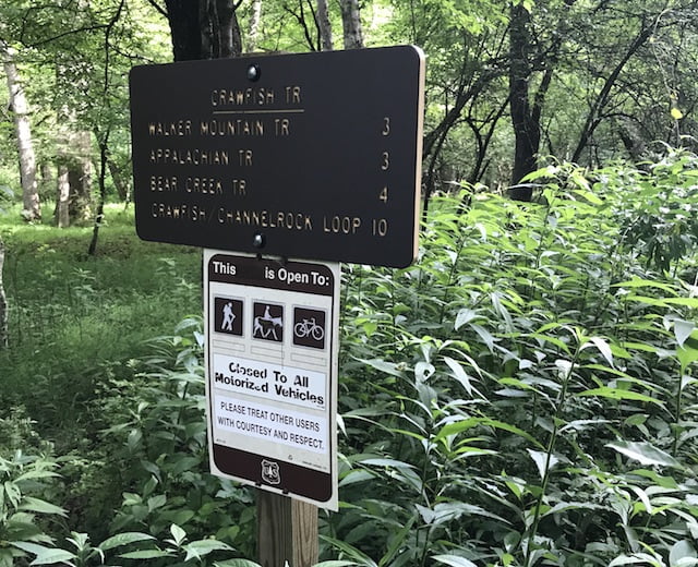
A few minutes later I slowed the car to a crawl at a probable parking spot. It wasn’t the circle lot I had seen on Google Earth. More of a sad ellipse. To be certain I wasn’t in the right place, I pulled up the route on my Garmin which showed we were still about a mile from the trailhead. Happy to not be where we needed to be, we continued down the road, passed through a shallow creek, and arrived at the trailhead cul-de-sac. FYI: As you near the end of Strawberry you’ll come across a few places that you’ll think are good spots to park, but follow the road until it ends (or just point your GPS to: 36.965309, -81.315290).
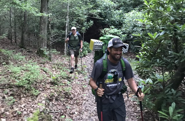
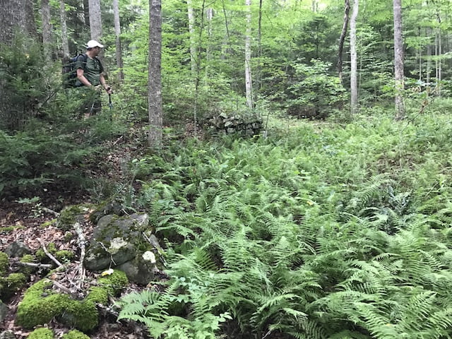
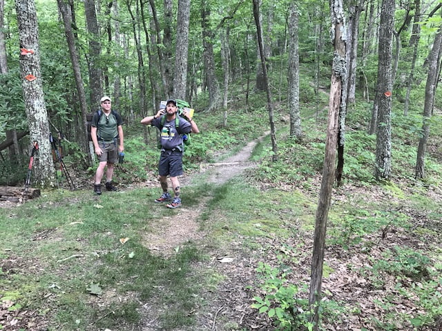
After parking and relieving pressure from down under, we lathered up with DEET, threw on our packs, and started down the trail at 5:40PM. The sign at the trailhead said we had three miles to the AT, but it was more like three and a half miles—two to the end of Strawberry Road and one and a half more to the AT. Maybe the sign maker wasn’t fond of decimals.
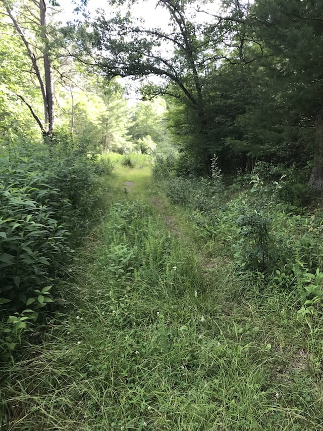
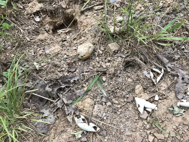
The road/trail was an overgrown mess of grass and weeds for the most part with gravel and dirt thrown in for good measure. Thankfully, following a road is pretty easy especially when it’s marked with orange blazes. A quarter mile in, we happened upon a turtle digging a hole in the middle of the road. Was it digging a cathole? No, she was laying eggs…in the middle of the road no less.
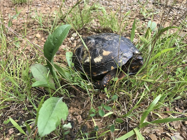
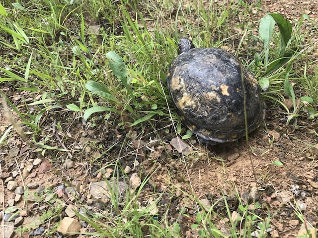
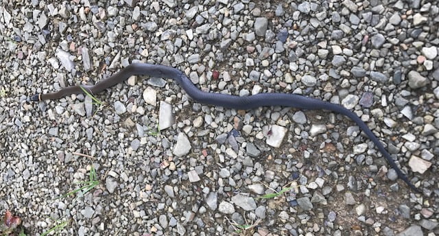
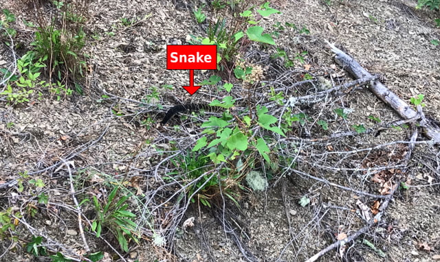
Twenty feet later we saw another turtle digging a hole. Then another. Then Ken spotted a 10″ northern ring-necked snake.
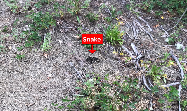
To cap it off, just down the path on the side of a hill less than 10 feet from us, I happened to glance over and see two Timber Rattlesnakes. They didn’t rattle, didn’t move, just sat there like Statler and Waldorf waiting for a chance to mock us. We kept our distance to ensure they remained calm (hence the photos from afar) and pressed on.
Over the next mile and a half snake sightings dwindled to zero, but turtle sightings increased by 800%. They were either digging a hole or on their way to dig one. We also happened upon the occasional turtle that’d been eaten, nest that’d been raided, and poop from a possible culprit.
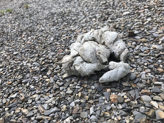
Beyond turtles, snakes, and coyotes, there was also evidence of bears. Not just seedy skat, but blackberry bushes that’d been ransacked, ant hills that’d been clawed open, and wide paths through tall grass in the field to our left/south.
At mile 2 the road ended in a field which led to a single track dirt trail. The trail took us southwest for a half mile where we crossed a couple of small creeks (even found a turkey decoy at one of ’em). A few minutes later we spooked a real turkey (or it spooked us) and it took off up a hill. Then another freaked out at the sight of us and took off into the woods with John’s bejesus.
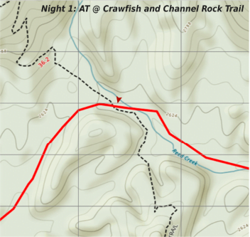
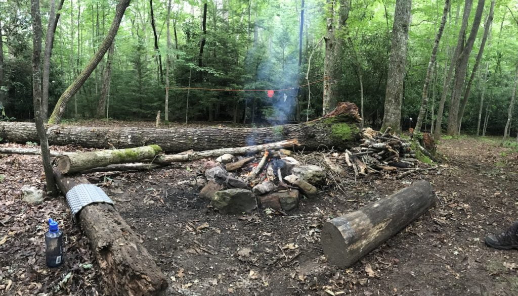
Three and a quarter miles in, after a short ascent, we came upon a campsite with room for at least 6 tents and a trail leading to a nearby creek. We made note of the location and continued on towards the AT in hopes of something closer to our destination. We climbed another short hill which led to the intersection of Walker Mountain Trail and CCR, turned left/south and continued on CCR. A tenth of a mile down the trail we hit a flowing creek with landscaping fabric on both sides. Thirty yards more, the AT and confusion.
At the intersection, the trail cuts in two directions. To the left/southeast is the AT. To the right/northwest, the AT and CCR. The CCR follows the AT for about 10 feet before turning left/southwest into and through a huge campsite—our campsite.
We arrived just after 7PM and picked out a spot to the northwest side of the CCR. As we set up we heard voices from the north. Before long we saw a dude in a trucker hat and running shorts leading a large group of youngsters. Unsure if he was lost, searching for water, or just looking for a place to stay the night I walked over and introduced myself.
He shared that he and a couple others were leading a group of 10 hikers on a 100-mile hike along the AT from Damascus. They were on Day 3 and ready to settle down for the night. He asked if they could share the campsite. Of course I said yes, and let them know we’d be starting a fire if they cared to join. I also mentioned the campsite off CCR if they needed to split up. He said thanks, talked to his group, and the wagon trail pulled into the site on the other side of the fire pit.
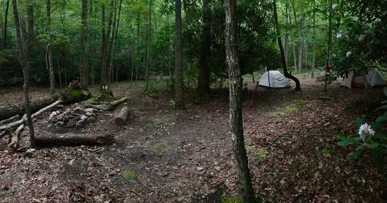
We finished up with our shelters, gathered wood, and started on the fire. On my last few trips I switched from store-bought fire starters to cotton balls coated in vaseline. I lit a couple and before long the fire was taking care of itself. Time for dinner!
As I shoveled food in my mouth I overheard the dude in the trucker hat explaining to another hiker how to set up a tarp. He kept saying “kitchen” and “dishes” and “food”. I didn’t think much of it until later when all 13 gathered around the tarp to cook, eat, and spill their food. When they finished making a mess they walked past our camp and hung their bear bags in the woods to the northwest. Fantastic!
Content with being between two pieces of bear bread, Ken, John, and I went on relaxing and yucking it up for a few hours before heading down CCR to hang our bear bags downwind and away from camp. See what I did there? We returned, doused the fire, and hit the sack ’round 11:30PM.
At 4AM on the dot, I woke to something walking clumsily through the woods to the southwest. I ruled out Ken and John because I could hear them snoring, and I ruled out our neighbors because I didn’t think they’d venture out without a light. To compound matters, my sleeping pad had slipped towards my feet causing the valve to dig into the small of my back, and…AND my bladder was at DEFCON 1 with turnkeys at the ready. After a short eternity the unknown heavy-footed creature made its way through the woods and I began to tackle my other two issues in the wrong order.
First, I attempted to lift my body using the sides of my hammock with the intent of pulling my very loud and crinkly sleeping pad back towards my big stupid head. This might have worked if I had actually lifted my body and if my pack wasn’t sitting on top of my pad and if I wasn’t in the hammock. Still, I persisted with the wrestling match for a few more minutes before my brain was fully charged and tagged in. With the help of my cranial teammate I proceeded to exit the hammock, empty my bladder, and adjust my sleeping pad. I’m a moron.
DAY 2 (10.23 MI | +1,978′ GAIN | -2,037′ LOSS)
We woke at 6:45AM, broke camp, grabbed our bear bags, and ate breakfast. Tuna, oatmeal, and coffee FTW! By 9AM we were waving goodbye to our neighbors and headed for campsite number two. If we stuck to the plan we’d finish our 7-mile hike and be eating lunch by 12:30PM near Monkey Run just shy of Strawberry Road.
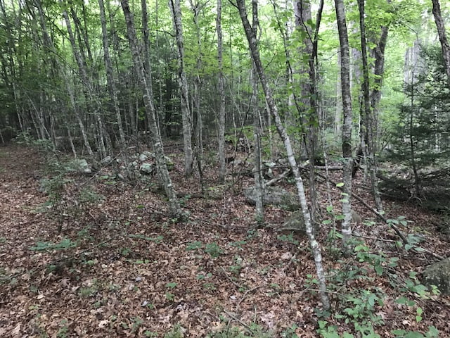
The first 1.5 miles were uneventful. A few creek crossings. Some smaller wildlife. A lot of flatulence. Nothing of note. Then the trail turned into a Louisiana swamp. The three of us looked at one another, the map, and the trail. Puzzled, we walked the muddy edge of the trail for 15 feet or so before realizing what had caused the trail to flood.
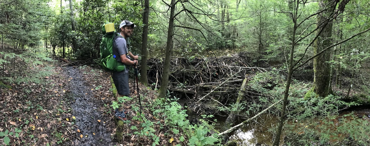
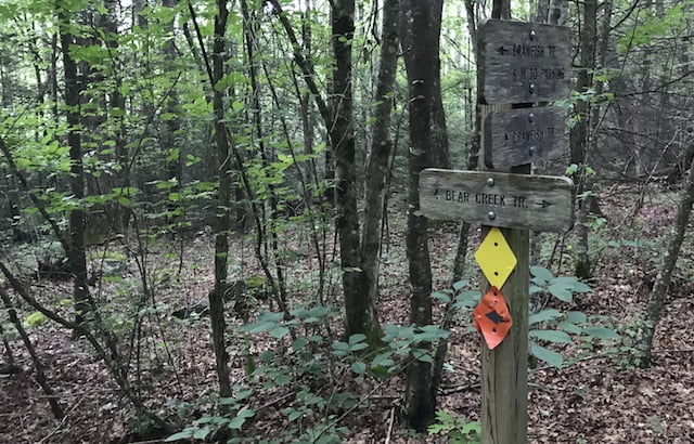
Another 10 minutes and we reached the Bear Creek (yellow blaze)/CCR (orange blaze) intersection. On the north side of the intersection were several piles of rocks that seemed to be manmade. Probably some super sacred burial ground that we disturbed and were now cursed as a result.
From the cemetery it was an easy 10-minute hike to the worst part of the morning. A 1.75 mile hike to the AT including an initial 700′ of gain in just over 3/4 mile. Every 100′ feet of climb resulted in a bucketful of sweat down my back, through my mooncrack, and ultimately into my shoes. Squish squish. I ain’t gonna lie. Between the heat and the humidity, I struggled to stay hydrated and energized. Thankfully, fresh blueberries, warm water, and the occasional wildlife sighting kept my spirits elevated throughout the 40-minute ascent.
At the top of the climb we were at a point where, on the map, it looked as if we’d join the AT. But when we looked around we didn’t see anything to suggest the trails were connected. Not that it mattered since joining the AT wasn’t necessary. Just thought it odd that no one had done this before. Now that I think of it we could’ve been trailblazers. Leaders of men! Instead, we’re just a bunch of nobodys! Anywho, we turned left/north up the CCR for 0.7 miles before crossing the AT around 3.25.
From the AT we followed the orange blazes up for a quarter mile, proceeded down a rolling 230′ descent for another quarter mile, then traversed a series of inclines, declines, and viewless peaks for about a mile.
At the peak before Groundhog Hill, we got off course thanks to a fork in the road which no one saw and which everyone took (I blame John). After five minutes of wandering we redirected ourselves back up the mountain (thanks Garmin), found the fork and an orange blaze, then descended and ascended southeast for a mile until we reached the top of Groundhog Hill. FYI, on Groundhog Hill there’s a second trail that runs to the south. Don’t take it. Stay to the left and follow the orange blazes. From Groundhog we made the mile-long, 415′ rolling descent to the next intersection.
At that intersection, CCR turns left/northwest towards Monkey Run (a creek) and right/southeast onto private property and eventually Big Turkey Knob trail. We stuck to CCR as our water was running low, our legs were getting heavy, and the midday sun was shining down hard.
Our next campsite was potentially a half mile down the trail (“down” as in descent and “potentially” as in on paper). When we arrived there was plenty of water, but no place to camp. We talked for a bit and decided to schlep the three miles back to our first night’s campsite and call it a day.
We hiked the remainder of the CCR loop which followed Monkey Run through the hollow. Around mile 8 we reached a concrete bridge of sort which was just below Strawberry Road. We had seen the bridge the day before but didn’t think much of it. Now it made sense. Back on Strawberry we picked up the pace; passing the turtle breeding grounds, the turkey decoy, the campground, and the trail sign to Walker Mountain before eventually arriving at the AT campsite around 2:20PM.
We dumped our packs and B-lined to the creek. Ken soaked his feet, I dumped water on my head, and John was contemplating his choice of friends. Once bottles and bags were refilled, we made our way back to camp whereupon I ran a line between two trees, stripped to my skivvies, and hung my clothes to dry. We sat around for a bit and hydrated before setting up shelters. Good thing, too, because just as we were finishing up we were greeted by a brief downpour. So much for dry clothes.
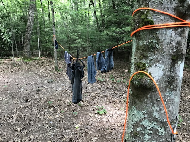
When the rain stopped the bugs came out in full force. To combat our flying friends I applied another layer of DEET and started up a fire to smoke ’em out. We sat around for a bit drinking water and snacking on junk food before rehydrating our pouched dinners.
Afterwards, we sat some more and shot the breeze (not an actual breeze because God forbid there be one of those). We joked how there weren’t any hikers on such a beautiful day and then two hikers and a dog passed by on the AT. We commented on how we hadn’t seen any wildlife in a while and Ken and John spotted a coyote in the southeast corner of camp. We then attempted to use our precognitive powers to order a pizza, but Dominos never showed.
Around 8PM we headed back down CCR to hang our bear bags. At 8:03PM I realized I had left the carabiner back at camp. I hurried back, grabbed the carabiner, and ran back down the trail to join Ken and John. When I shot around the corner onto the AT I startled a female hiker who was about 10 feet away. She pooped her pants. I pooped my pants. Then we exchanged greetings and parted ways. I made my way back to John and Ken (thankful the hiker didn’t have mace within reach), hung the bag, and the three of us returned to camp for a good night’s rest.
DAY 3 (3.52 MI | +131′ GAIN | -374′ LOSS)
The plan was to sleep in until 8AM and head out around 9AM. When I woke at 6AM everyone was still nestled in their tents. At 7:15AM I peeked out and saw John folding up his tent. Not wanting to be the last to pack up, I rolled out of my hammock to find Ken had already packed up and was telling a tale of mass hysteria involving a giant spider and a coyote. I hurriedly broke camp and we were off and running by 8:18AM.
The hike went a little faster than the first day; in reverse, the trail had less gain and more loss. We also had fresh legs and were motivated by breakfast. Mmm. Pancakes. We reached Strawberry Road in just over 30 minutes and our car another hour after that. It was a great way to end a solid trip.
Final Thoughts
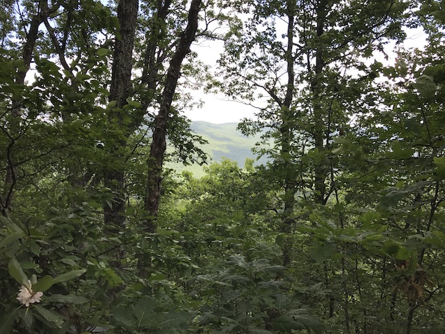
Crawfish and Channel Rock is a good, moderate lollipop route with challenging hills, good water sources, and plenty of wildlife. We made the most out of the available campsites and even snuck in a few extra miles. If you’re looking for a route in the Mt. Rogers National Recreation Area and don’t mind the lack of views, I highly recommend CCR and the campsite at the CCR-AT intersection.