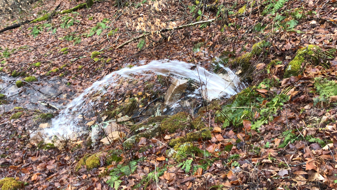
Photo by Coop
Backpacking in the winter can be a challenge due to the uncertainty that accompanies the cold season. However, if you’re willing to accept the risk, the rewards are incredible. For that reason, my buddy Coop and I make it a point to plan a yearly winter trip. More often than not, we find ourselves in the Mount Rogers National Recreation Area (NRA), a nearly 200,000 acre National Forest in southwestern Virginia. This year, Coop suggested we continue the trend and return to the NRA to tackle the northern section of the Iron Mountain Trail (IMT).
The yellow-blazed Iron Mountain Trail spans 47 miles from Highway 91 near Tennessee in the south to VA16 at Iron Mountain Gap in the north. Up until 1972, the IMT was part of the Appalachian Trail when it was relocated to the south to accommodate communication towers and power lines in order to maintain the secluded experience hikers have come to expect from the AT. The IMT is well-maintained thanks to local volunteers, has an old AT shelter in the northern section that’s in great condition, and as it turns out, is also the perfect location for our latest adventure.
THE PLAN
With our destination chosen, Coop used the mapping website, GAIA GPS, to plot two possible routes starting at Fairview parking lot off VA603. Route A took into account the possibility of snow, was limited to 14 miles over 3 days, and included a bailout option that cut the route in half if things got really nasty. Route B (which Coop dubbed the Iron Mountain Marathon) was considerably longer, 27 miles over 4 days, and came with the condition that heavy snow was neither on the ground or in the forecast.
Ten days out, the forecast looked soggy and cold, but no snow. Hurray! Seven days out, snow. Boo! Five days out, snow and ice. Double boo! Three days out, rain, rain, and more rain. Yay? I mean, YAY!
After we agreed on Route B, Coop built out the trip in our spreadsheet based on a 1.5 MPH pace…

…created an elevation profile using Google Earth
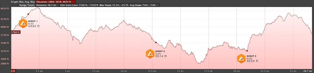
…dropped in the route
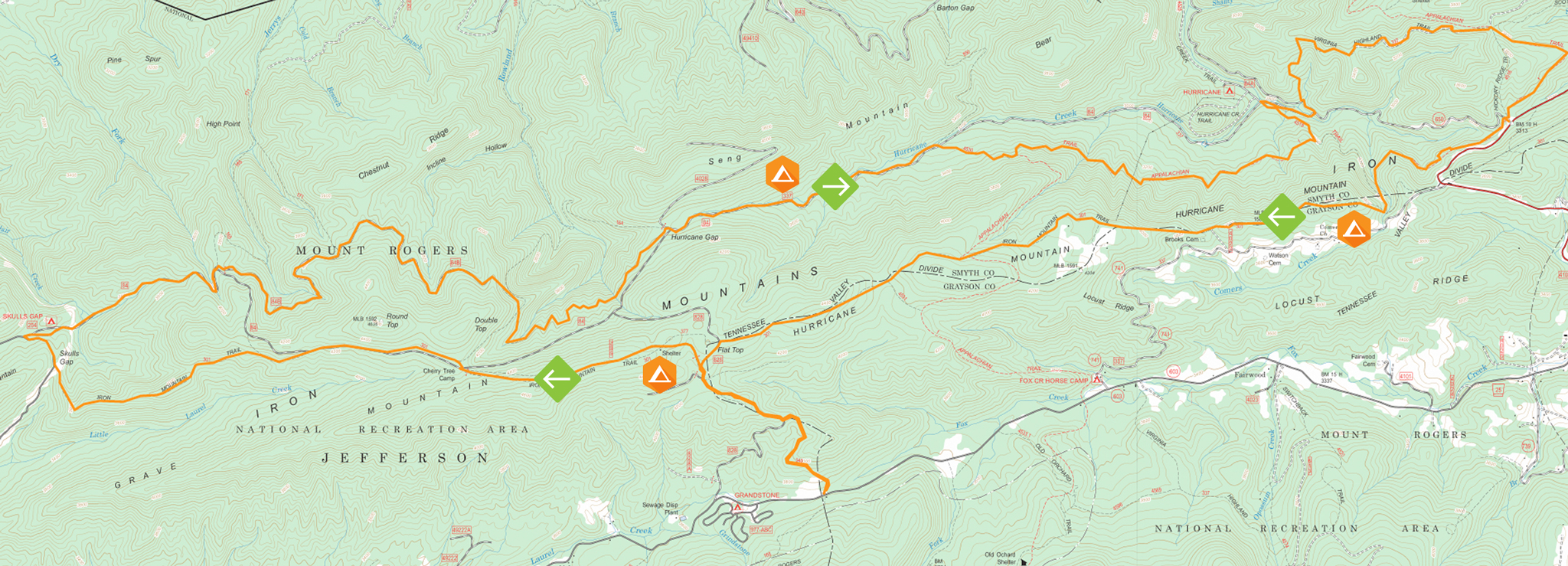
and packaged it all in a map he printed on TerraSlate paper. We then loaded the route into our respective GPS watches and waited for the big day.
PACKING IT IN
In the last year I’ve taken to weighing every piece of gear I own and loading it in a spreadsheet that I use to populate each trip’s gear list. Yes, I know it’s a little obsessive, OK, a lot obsessive, but doing so helps me make sense of what I need to bring, and what I don’t need, but am willing to carry. God, I really have too much time on my hands.
With everything stuffed inside, my pack tipped the scale at 33 lbs 6.7 oz; about 3 pounds more than I would normally carry in the winter time. I attribute the extra weight to several things. For starters, winter trips are typically heavier on the pack due to the additional clothing needed to stay warm. The amount of forecasted rain meant I had to bring rain gear, and also gave me a legitimate reason to bring additional fire starting options beyond my usual vaseline-coated cotton balls. The trip’s duration and overall mileage required more calories which translated into more ounces and pounds of consumables. And, because winter doesn’t always mean an abundance of water, I swapped out one of my 32 oz Nalgenes for a 48 oz bottle which, when full, added a little over a pound.
Then there were the nonessentials. I brought my Helinox Chair Zero, a deck of playing cards, and my son’s Nemo pillow which added 1.5 pounds. And, since we planned on cooking real food the first night, I brought along 2, 10 oz potatoes (which, thankfully, I only had to carry on the hike up the first day). OK, so I probably should have left the chair. Nah, who’m I kidding? I love my chair!
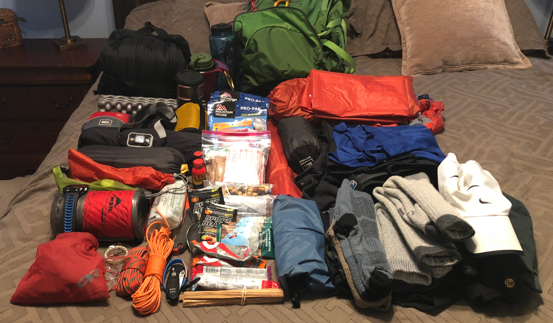
If you’re wondering if the estimated weight generated by my spreadsheet was accurate, the answer is yes. When I weighed my pack on a scale, I was off by a single ounce. Pretty cool, huh? And if you’re curious about everything I crammed inside my pack, you can download the complete list of things I brought with me on this trip.
DAY 1 (1.73 MI | +726′ GAIN | -49′ LOSS)
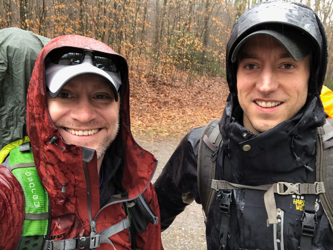
I arrived at Fairview around 2:40PM to find Coop waiting for me in the rain. As quickly as I could, I donned my rain gear, laced up my boots, and loaded my pack before the two of us headed out at 2:55PM. From the trailhead, Cherry Tree Shelter was 1.73 miles with a little over 700′ of gain and six Manute Bol’s worth of elevation loss.
We followed a muddy single track trail for about 0.75 miles before switching to a paved and rocky road for most of the last mile. At the top, the road opened to a clearing with a shelter, a privy, and a trail sign for east and westbound IMT traffic.
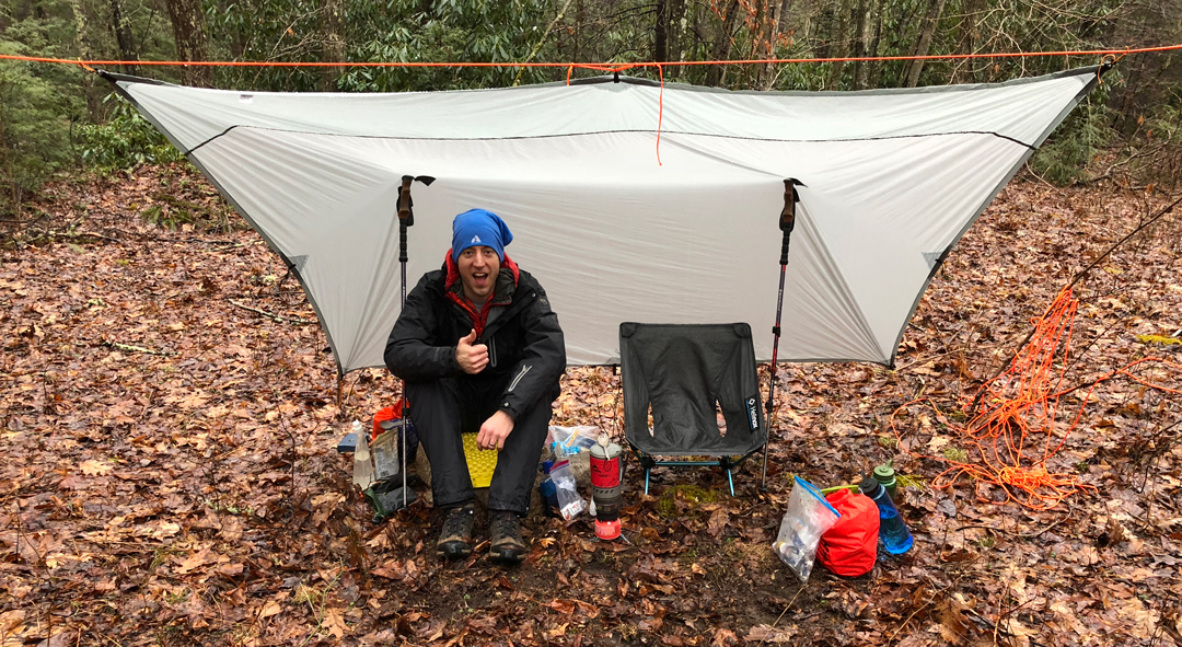
At the shelter, we hung things to dry, sent out proof-of-life texts to our spouses, and turned our attention to building a fire. We did our best to collect dry-ish wood, and then built up the fire ring. After Coop built a platform with a teepee, we covered the pit with logs to shield it from the rain. Then, I dug out my fire bag.
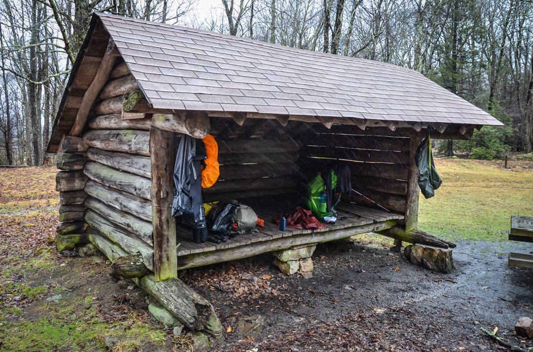
Photo by Coop
My usual fire-starting kit includes a couple Coghlan’s fire sticks, a few pieces of fatwood, a Ziploc bag of vaseline-coasted cotton balls, waterproof matches, a lighter, and a striker. For this trip, since we’d be dealing with rain most of the trip, I brought along some new-to-me fire starters including a Coghlan’s fire disc (aka, the hamburger), a few Coghlan’s emergency tinder (aka flaming ear plugs), and a couple SOL all-weather fire cubes (aka fire marshmallows).
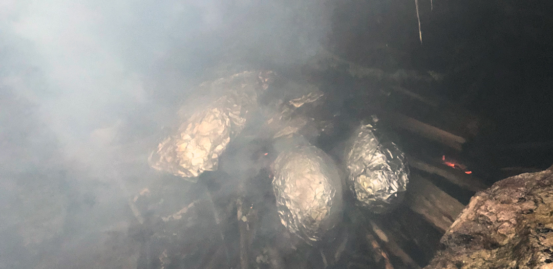
Given SOL’s reputation for emergency supplies, we gave their fire cube the first shot at starting a fire. Once lit, it showed signs of promise, but after 30 seconds or so, it died out. A second later, it caught fire again only to die out even quicker than it had before. After about five minutes of burning and not burning, the marshmallow’s slow painful life came to an end; and we had nothing to show for its efforts. Unimpressed with the fire cube, Coop added a couple pieces of fatwood and a fire stick to the pile, two things that we knew from experience could get a flame going. With a little patience, some fanning with my Therm-a-Rest Z-seat pad, and a great deal of persistence, the wood started to burn. Another few minutes of fanning, coupled with a bit of TLC, the fire was strong enough to begin cooking our pork chops and potatoes.
As dinner cooked, we talked about sleeping in the shelter so we could prolong the soaking of our tents by a day. We agreed to agree and threw our bags down over our tent footprints. As we ate, something in the corner of the shelter caught my eye. Perhaps it was just the way my light bounced off the wall. Maybe it was the Babadook. But then I saw it again—a beady-eyed, white and gray mouse. It stood there, staring at me for a moment, before it darted off behind the wall. It took zero words to agree that we’d be sleeping in our tents away from the shelter. No, I’m not scared of mice, but I am afraid of disease and would prefer not to have a hole in my pack.
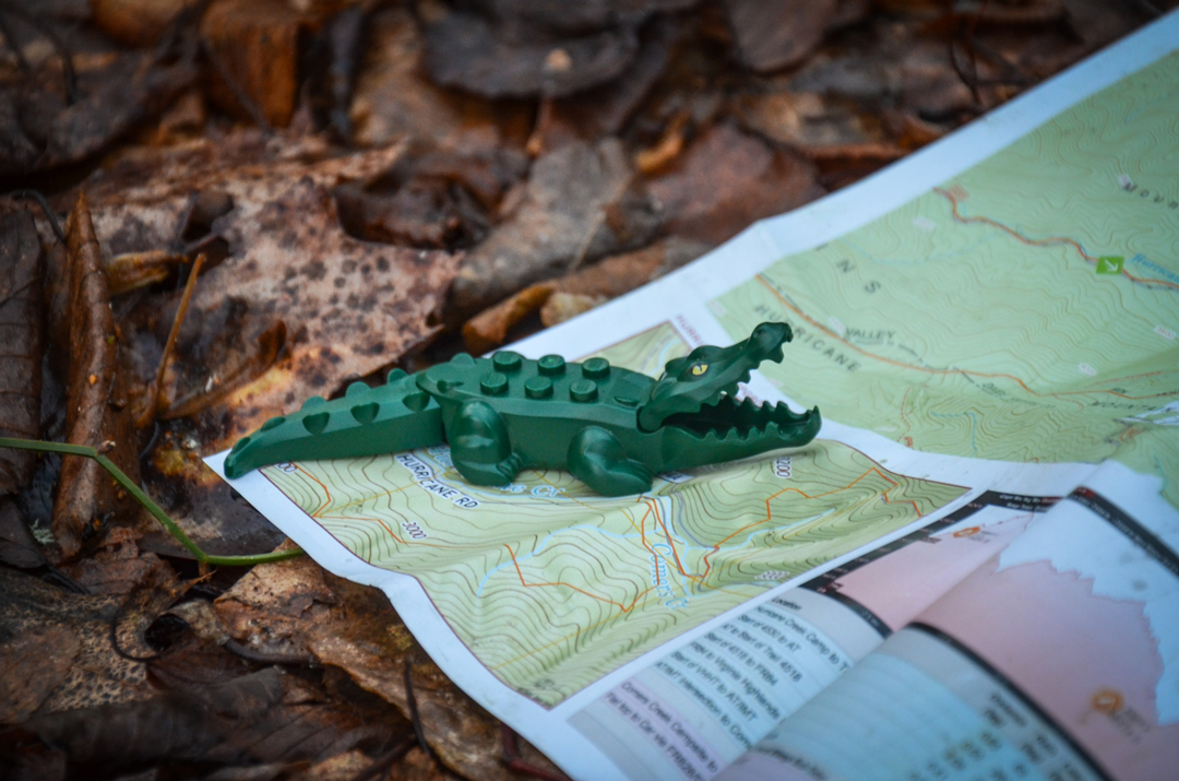
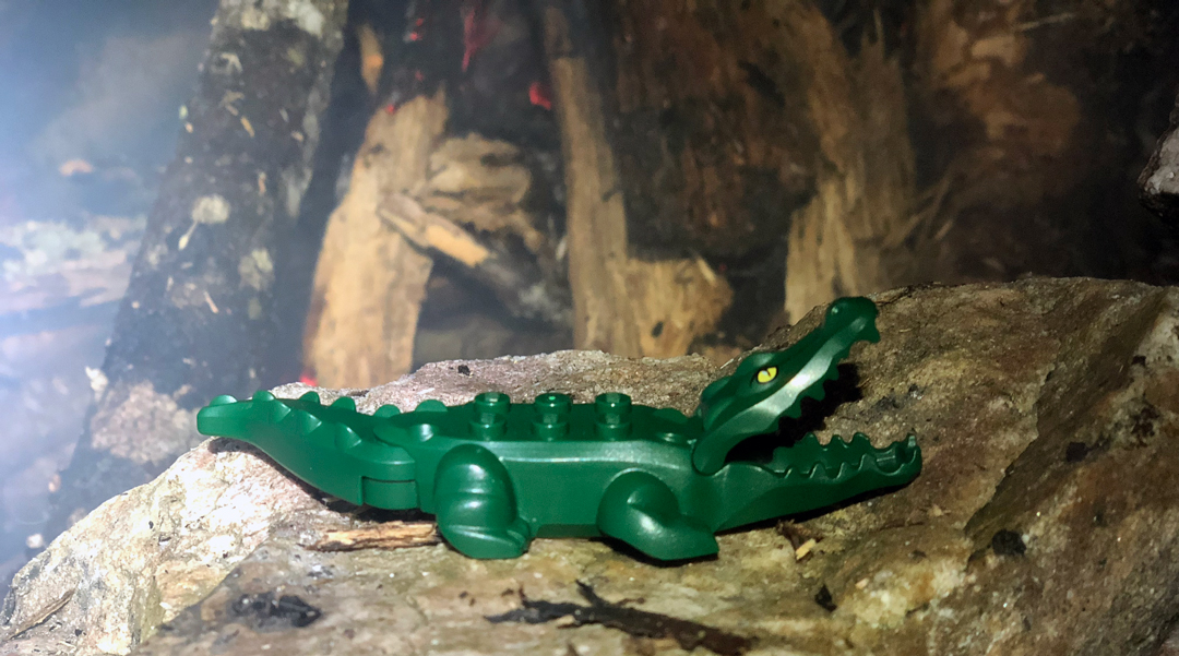
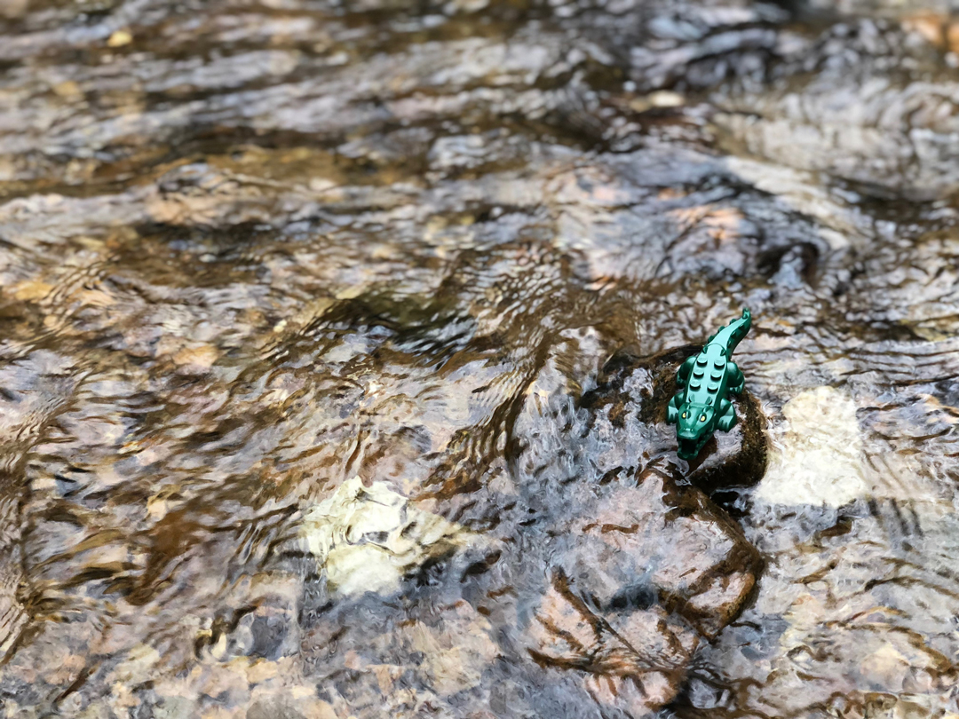
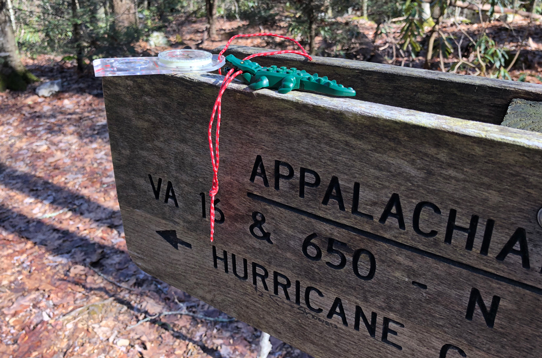
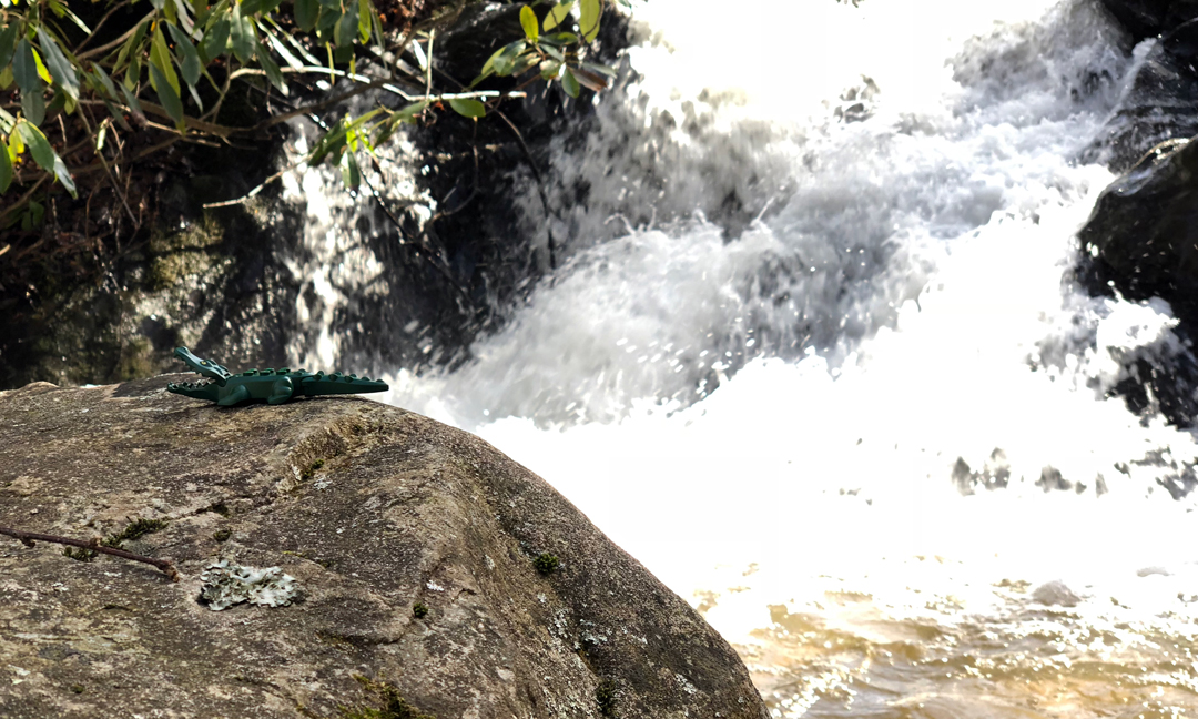
Once our tents were up and our gear moved inside, we tried our hand at survival cards; basically a deck of playing cards with survival tips such as making spears and tying knots. As we played, the rain returned and it brought wind and cold along for the ride. I dug out my down jacket and tucked my hands into my pockets. To my surprise, I felt something inside. No, not the mouse, though that would’ve been…interesting. It was one my son’s LEGOs; a green crocodile we named Crocodile A-T.
Around 11PM, after making our way through a suit of cards, we hung our bear bags and called it a night. OK, it didn’t go exactly like that. More like, I tied paracord to a rock, threw it over a branch, and the rock got stuck. Unable to free the line, I cut the paracord and tried again. Once more, I tied the end of the shortened length of paracord to a rock, threw it over a branch, and it, too, got stuck. After cutting the paracord for a second time, I relinquished my role as rock tosser to Coop who nailed it on his third attempt. Once that happened, then we hung the bear bags and called it a night.
DAY 2 (12.27 MI | +1,670′ GAIN | -2,382′ LOSS)
We woke around 6:30AM, broke camp, filled up on water at a spring near the shelter, and stuffed our faces with calories. The skies were overcast and the air was cool. On the plus side, no rain. Since we had reception, I checked the weath…oh fudgepooters! Evidently, I left my phone powered on all night bringing its battery life down to a dismal 62%. As a result, I had to power off my phone when I wasn’t using it, and wait 35 seconds for it to power on when I wanted to. First world problems, I know.
Right, so, the weather. I checked the weather and it appeared that the chances of rain were hovering around 20% until about 4PM at which time the chances jumped to a confident 100%. On the upside, we’d likely stay dry for the day’s 11-mile hike. On the downside, if we didn’t get to our campsite before 4PM we’d be setting up in a mess. Go team!
With new knowledge in hand, we headed west following the yellow-blazed IMT. The trail was expectedly sloshy all the way to the top of Grave Mountain—0.75 miles from the shelter. From the peak, it was a quick half-mile descent until we reached Cherry Tree Camp and our first recalculating moment of the trip.
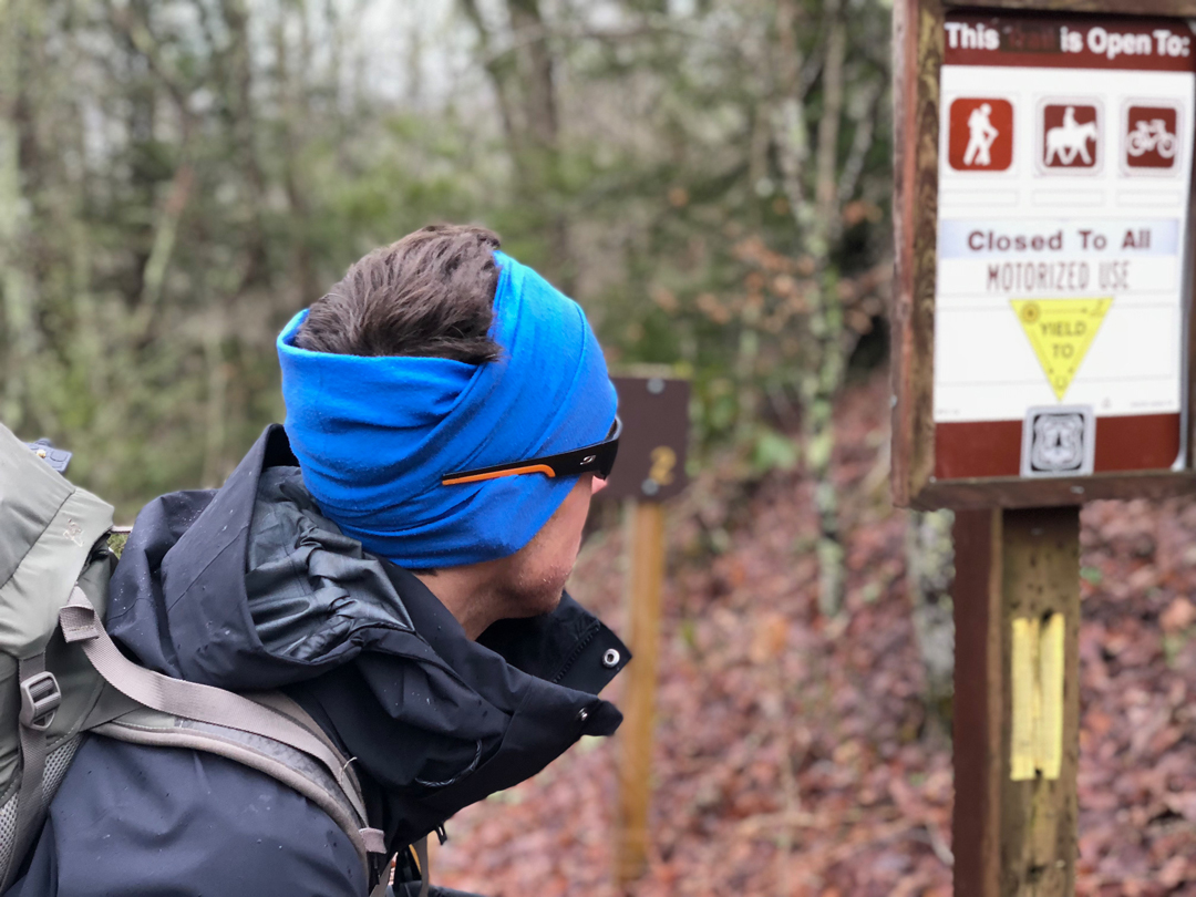
When we rolled into Cherry Tree Camp off of IMT we had multiple options. Two of the options, in addition to the IMT, headed back east. One of them was a dirt road that cut north-northeast as it ran the base of Double Top, and the other was Forest Road 84 that cut back northeast towards Hurricane Gap. Lest not forget our westerly options—Forest Road 84 and a yellow-blazed trail. We ruled out the options that headed back east, and considered the remaining two. Since the IMT is blazed yellow we ignored FR84 (the trail we were supposed to be on eventually) and headed down the yellow-blazed trail because it was blazed yellow, as in the I-M-T.
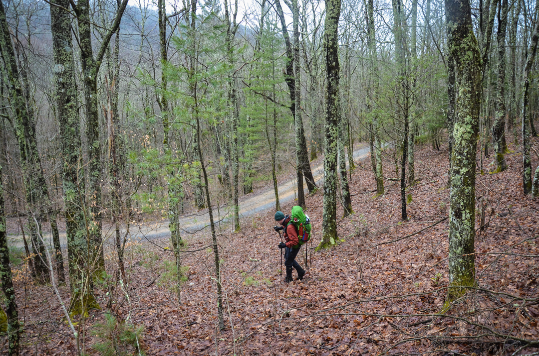
Photo by Coop
About 6 or 7 minutes later our initial hesitation was realized. The trail was no longer blazed yellow and we were walking up and around instead of along the contour and down. With maps and compasses in hand, we determined we were, indeed, headed northwest instead of west. Thankfully the correction was easy—head south and bushwhack to FR84. So, we did, and we were back on course after a few minutes. Turns out, after reviewing the map later, the trail we were following cuts through Round Top and Double Top and possibly continues on to old Forest Road 84B. Still not sure why it was blazed yellow, but whatever.
We continued down FR84 passing hundreds of empty Bud Light cans until we reached a sign for the IMT where the trail picks up again and FR84 forks off to the northwest.
From this point we had about 2.75 miles until Whitetop Road just south of the Skulls Gap picnic area on the eastern side of Straight Mountain. At Whitetop, we crossed the road and climbed a long hill that leveled out before snaking around the side of Straight Mountain and eventually dumping into the picnic area; complete with a dilapidated his-and-hers bathroom that might as well have been a tomb. At the bottom of the hill we crossed over Whitetop Road once more before joining up with FR84, that stupid gravel road that kept finding its way into our day’s hike, again.
From Whitetop, it was a long and boring 1.25 mile hike up FR84 to our next turn. On the right, the mountainside goes up sharply. On the left, the landscape gently falls off to Dry Fork Creek below. Along the entire road, on either side, tires littered the ground. Tons and tons of tires. Seriously, there were a lot of tires.
After what seemed like forever, we reached the intersection of FR84 and FR84B. The former skirts right and south, and the older, wiser 84 goes straight/north past an old gate before heading south-southeast. Once through the gate we passed a trailhead to Jerry’s Creek trail which, according to the map, shot off north a ways before looping back to FR84B. We didn’t have time to visit Jerry or his watering hole, so we stuck to the forest road and continued the climb past Round Top and Double Top where the road ended and a dirt trail began.
We took the trail south for a quarter mile before crossing another intersecting trail from the southwest which we determined leads to Cherry Tree Camp. Since that was not our destination we continued south on our current trail which after 2.5 miles led us to Hurricane Gap and more options. Sweet Moses, this whole area was like Escher’s Relativity painting. To the west, Rowland Creek. To the north, 4028 heads off to the top of Seng Mountain. To the southwest, Hurricane Road (which is still technically FR84) finds its way back to FR84 where it isn’t named Hurricane Road, and to the east, Hurricane Road (aka FR84) follows Hurricane Creek and if the gods were in our favor, would lead us to our second night’s campsite. What the actual flock of seagulls?
As we made our way through the labyrinth, it donned on me that we hadn’t seen a campsite or a fire ring or a place we could call a campsite and build a fire ring since Cherry Tree Camp 9.5 miles back. This wasn’t great news, but we were still hopeful that we’d find something along Hurricane Road.
From the gap we walked about a mile before old Eagle Eye Coop spotted a turnout with a fire ring. Eureka! We looked around and it was perfectly positioned alongside Hurricane Creek with enough space for a mariachi band and two tents.
Without haste, we took off our packs and began setting up camp. If the weather forecast was right, we’d be saturated in about 2 hours. Once set up, we turned our attention to the fire. There was a pile of wood left by a previous camper which meant we only needed to gather the small stuff. As Coop prepped the fire, I gathered rocks for a bench. Sure, I had a chair, but Coop’s not an animal, and he shouldn’t have to sit on the ground. As soon as we completed both tasks, the rain started. The slow falling sprinkles gave us hope that we’d be able to enjoy the fire for a bit. As the rain continued, Coop used the fire disc (which is supposed to burn for 30 minutes) in an attempt to salvage the fire until the rain let up. The disc burned as advertised, but Mother Nature brought her A game.
Immediately, Coop grabbed his tarp and set up a spot for us to cook, eat, and relax until the rain subsided. He did. We did. The rain, however, did not. In the distance we could see the hamburger still fighting the good fight, until it had nothing left to give. While the burger couldn’t keep our fire going in the rain, we appreciated its effort and agreed it’d be worth trying on a future trip.
By 6:30PM I was beginning to feel the chills of the rain and wind that managed to find its way down the back of my shirt and pants, so I decided to head off to the comfort and warmth of my zero bag.
Thirty minutes later, Coop retreated to his tent.
Apart from answering nature’s call, neither of us left our tents until the next morning.
DAY 3 (15.01 MI | +3,265′ GAIN | -2,448′ LOSS)
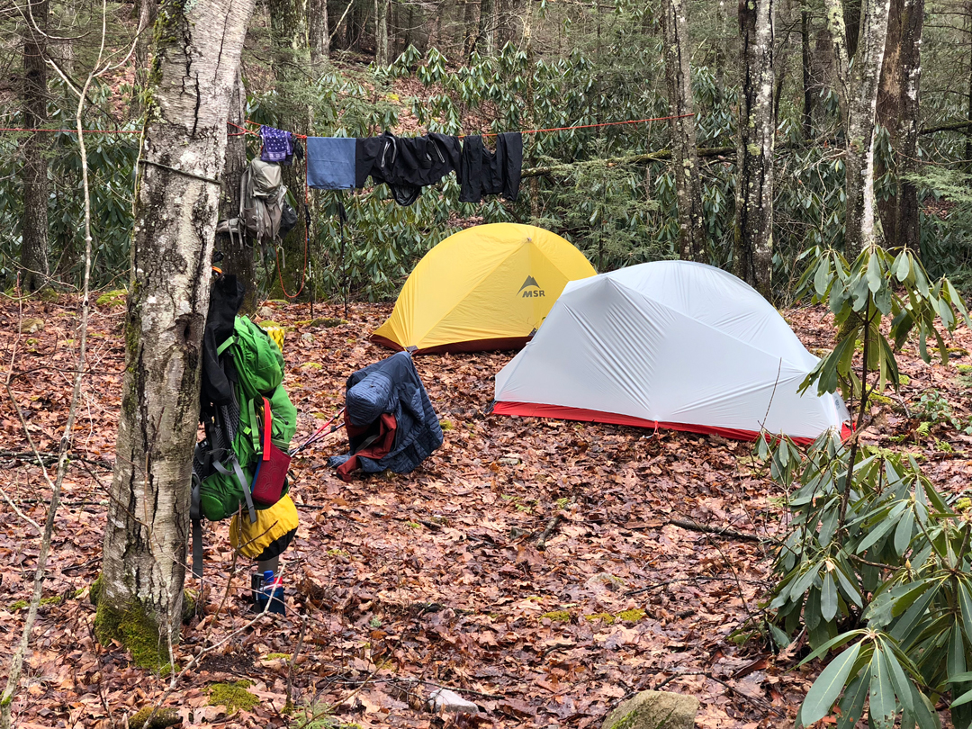
I woke at 5:30AM and listened to the rain for a little while longer before it eventually tapered off around 6AM. Twenty minutes later, Coop began his morning routine and the two of us proceeded to break things down. Our intent was to head out about 8:30AM which meant we had time to hang our tents out to dry for a bit. As they did, we finished packing, ate breakfast, and enjoyed a cup of hot chocolate complete with mini-mallows.
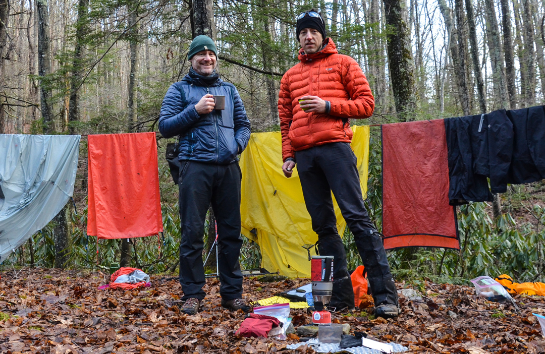
Photo by Coop
Around 8AM, I glanced at my tent. From where I was standing, it looked like the water hadn’t budged at all. Upon closer inspection, the reason was clear. The water on our tents, rain jackets, and rain pants had changed from a liquid to a solid. Strange, it didn’t feel that cold, but looking at the thermometer and adjusting for wind chill, the air was definitely sub-freezing. Coop commented that the frozen droplets weren’t such a bad thing because it made the process of removing the water from our gear much easier. He was correct. With just a few swats our gear was ice-free.
We finished packing, completed one last “Leave No Trace” sweep, and set off for an 8.29 mile hike to our third night’s campsite at Comers Creek. After following Hurricane Road for a mile we reached the Hurricane Creek trailhead which heads south towards the Appalachian Trail.
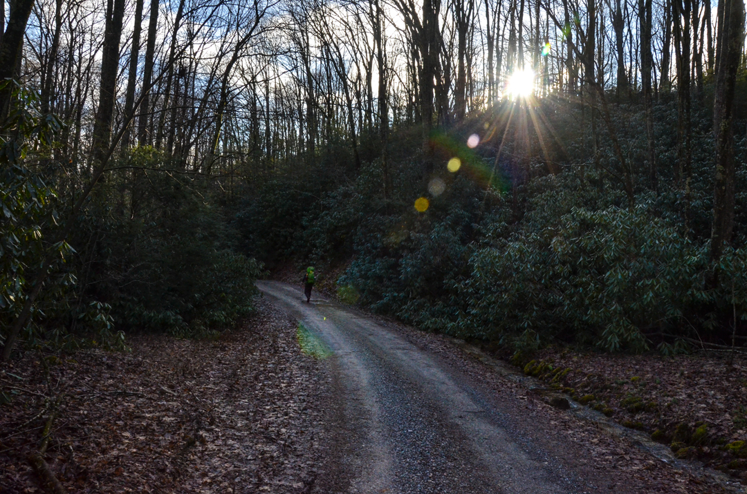
Photo by Coop
We hung a right on Hurricane Creek Trail, walked a half mile down the trail, and came to a sign that pointed to two places: Hurricane Shelter to the south and the AT to the northeast. This was our second recalculating moment of the trip. In my research, I had read about two AT shelters in the area—Old Orchard to the south of our location and Raccoon Branch to the north. I read that Hurricane Shelter replaced Raccoon Branch, but I should have read the information a little more closely.
Coop and I looked around, studied our maps, and examined the contours. It didn’t make sense that Hurricane Shelter was south of our location because it should’ve been to the north (at least according to my incomplete research). Well, we ignored our instincts for the second time and schlepped it up the trail towards Hurricane Shelter figuring it would bend back north. Thankfully, we had a Star Wars bad feeling and turned around about 0.4 of a mile from the intersection (and apparently less than a quarter mile from Hurricane Shelter). Back at the sign we hung a right and headed down the AT in the correct direction. You see, as I would read upon my return, Raccoon Shelter wasn’t replaced by Hurricane Shelter, as in knocked down and built over. Raccoon Shelter was completely dismantled, and Hurricane Shelter was built in an entirely different location, as in, up the trail from where we took the wrong turn. I should probably read the entire article next time.
Back on the right path, we followed the white blazes for about 2.5 miles, crossing a power line about a mile in, several flowing creeks, and passing more than a hundred moss covered trolls. We reached our next turn at the AT/4630 intersection just before 11AM. We then followed the blue-blazed, half-mile trail down to Hurricane Road/FR84 just shy of the Hurricane Campground entrance.
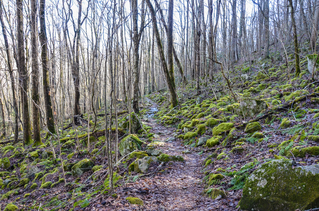
Photo by Coop
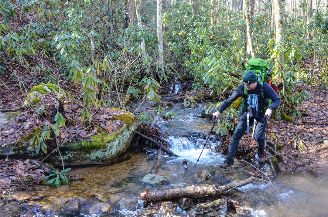
Photo by Coop
At the road, we passed the campground and headed southeast on Hurricane Road/FR84 for a half mile, then left/northwest on Comers Creek Road for a tenth of a mile, and after many uncounted minutes found ourselves at the Virginia Highlands Horse Trail trailhead.
What struck me about this part of our route wasn’t just that it was a ridiculously steep climb, but that it was a horse trail. Now, I’m not a horse, but if I was and I had to carry a person and their gear up this precariously narrow trail, I’d be pissed. For a solid mile and a half the trail went up and the sweat on my back went down (my butt crack). When the trail leveled off, I took a moment to pull my underwear out from between my cheeks, drank a bit of water, and finished the remaining half mile to the AT.
From the intersection, we followed the white blazes south for 25 minutes before arriving at Dickey Gap (which is midway between the AT/VA Highlands Horse Trail and Comers Creek Falls). From the gap, we crossed VA650 then jumped back on the AT for another mile.
At the falls, we crossed a bridge, walked a bit more, and were greeted by the only two people we’d see the entire trip; an older couple that had come to see the falls (and who kind of reminded me of that old couple from Cloak and Dagger). We exchanged greetings and pressed on to the AT-IMT intersection where the AT turned north to Hurricane Campground and the IMT went south. We turned left/south and started talking about our options as we maneuvered ourselves over and around a fallen tree.
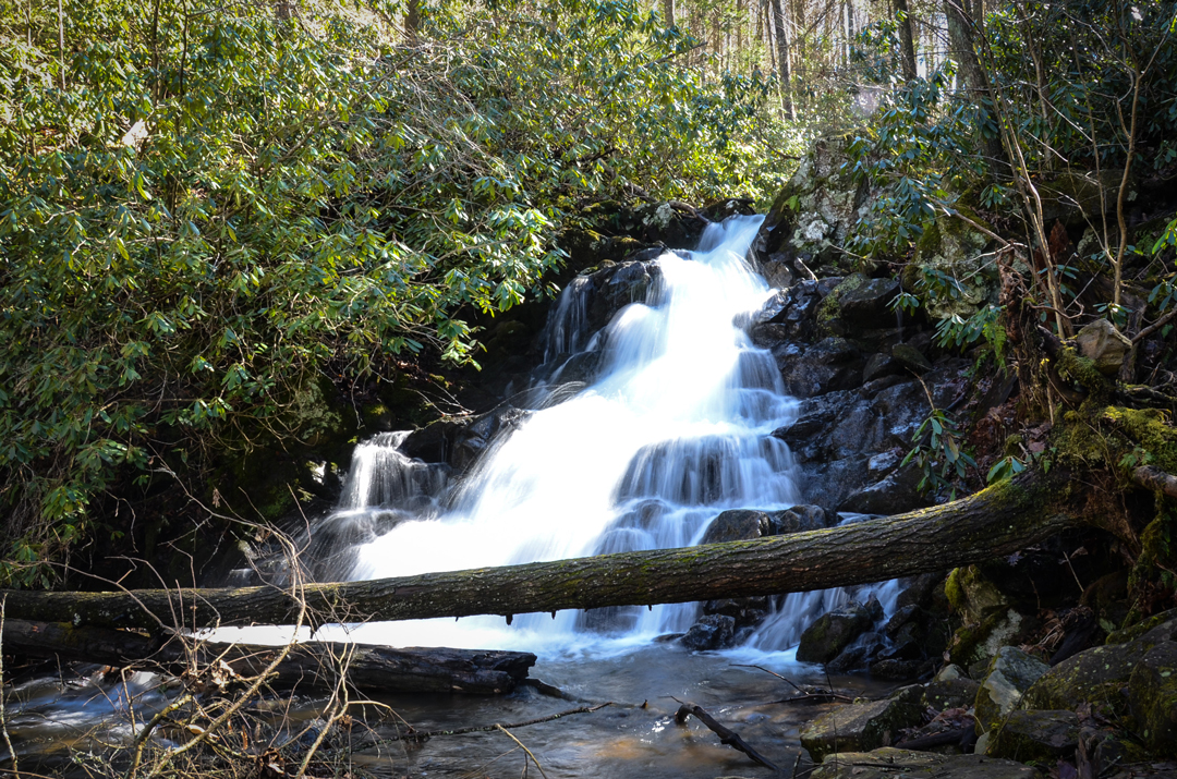
Photo by Coop
Given the fact that we’d only seen two campsites in the 20+ miles since Cherry Tree Shelter, we discussed returning to Cherry Tree for the night. As we walked, we had all but made up our minds. Then, less than a quarter mile up the trail, we came across one of the most picturesque and spectacular campsites I’ve ever seen. Just off the path, a big dirt clearing with a fire ring sitting right next to Comers Creek and a waterfall in the background to boot. Coop and I looked at each other and agreed that we’d at least break for lunch.
While we ate, he and I talked through our options. We could stay at this super awesome campsite and not walk anymore for the rest of the day. Then, in the morning, we’d huff it back to the car (which is kind of exactly like what we had planned to do initially). From our current location that would amount to a 5.75 miles hike with roughly 1,800′ of gain and 1,300′ of loss. If we did, there was a 60% to 80% chance that our morning hike would be a mushy, sloppy, miserable mess. If, instead, we pushed on to the shelter, we could take advantage of the 5 hours of existing daylight and near perfect weather. We sat some more, thinking about our tired, aching muscles. Another 1,800′ of gain to the shelter would be doable, but it’d be a challenge. But, we had a great site right where we were sitting…with our packs off…not moving. Decisions. Decisions.
Then I said what we’d both been thinking, “Let’s head to the shelter.” Coop agreed. And that was that. With tuna in our bellies and packs on our backs, we proceeded to put one foot in front of the other. Albeit slowly.
From the campsite, the IMT switched back up the mountainside following a barbed wire fence to the top. A sharp left and we walked through a gate leading to a pasture, passed another campsite, then squished through another gate at the southern side of the pasture. From there, the trail went straight up like the green mile to eternity. We took our time. By that I mean our legs were really flat and our sense of urgency just wasn’t there. But we figured, even at 2 MPH we’d make it to the shelter before sundown. Some thirty minutes later, the climbing stopped just shy of the end of the power line we’d seen earlier in the day.
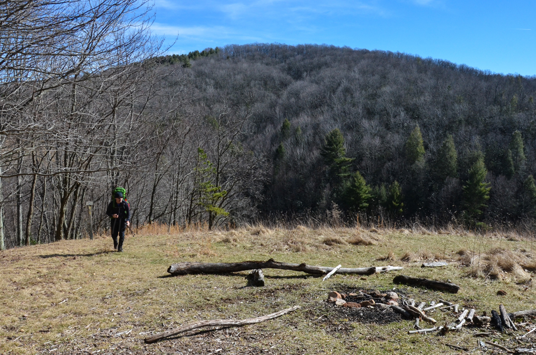
Photo by Coop
At this point, based on the trail sign we’d seen at the falls, we figured we had about a mile and a half before we’d reach the AT. This is also the moment when my Garmin alerted me that its battery was low. Based on previous experience, I had about 30 or 40 minutes before my watch went dark. No worries, right? I mean, sure the watch’s course map feature helped us recalculate twice before, but we just had to follow the IMT straight to the shelter so I wouldn’t need to use it again. Right? RIGHT?!
Just shy of the 2.75 mile mark, we started looking for the AT and its characteristic white blazes. With our eyes peeled we spotted, not a blaze, but a trail branching off to the left. Since we were on the IMT, and it runs east to west, we figured that the other trail was the southbound AT. And, because on the map, the northbound AT picks up after the southbound AT, we needed to stay on the trail we were hiking. One problem with that theory. My watch was showing we were headed north which meant the trail ahead of us was the northbound AT which led to Hurricane Shelter, and the trail to our left was heading west which meant it was the IMT. Given technology’s bad rap in the wilderness, we double-checked our bearings with our real needle and dial compasses. They both corroborated my Garmin’s story. We turned left and started heading west down the trail
About 200 yards in, we spotted a white blaze. A white…friggin’…blaze. Looking at our compasses we were now headed south. Since south was bad we turned around and headed back to the intersection to take the northbound trail. We walked it for 200 yards before seeing a white blaze on this trail, too. The main difference between this trail and the one we were just on, was that this trail only went north. In fact, it was starting to turn northeast. FTLOG! We backtracked once more and returned to our original trail of choice and kept going with the assumption that I was Lewis and Coop was Clark.
Roughly 300 yards down the trail Coop let out a sigh of relief when he noticed a faint yellow blaze on the tree. Confident/Relieved that we were headed in the right direction, we followed the path to an intersection a half mile down the trail where a sign pointed to the southbound AT and to the Cherry Tree Shelter. We had two miles to go. Thank you 8 lbs 6 oz, newborn infant Jesus!
Before completing the last of our hike, we took a breather, downed some water, ate a couple Clif blocks, and checked the map. The elevation profile showed a pretty long decline before a short incline just beyond Flat Top. “We got this.” Coop said, and then we took off. He took the lead at a pretty quick pace. About 0.8 mile in, my watch died. Not long after that, Coop started to slow. He’d been pulling us along the whole day and now it was my turn to return the favor. I took the lead and picked up the pace. A couple minutes went by and Coop let me know that we were hiking at 3.4 MPH (17:38 min/mi). We were stoked with our pace and weren’t showing any signs of slowing down. When I spotted the gate at Flat Top I knew we only had a quarter mile to go which also meant we’d need to climb one last time. Neither of us let up for a second, and in just under 39 minutes from the intersection two miles back, we reached the shelter.
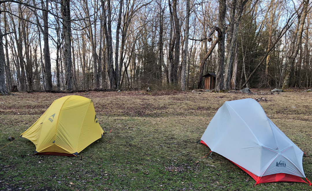
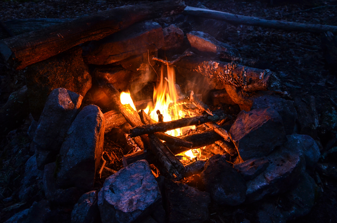
Photo by Coop
Ecstatic that we’d finished the 15-mile hike, we dumped our packs and got to work. Tents up, stoves out, we turned our attention to the fire. For this round, we decided to try the Coghlan earplugs. Holy balls, those things are worthless. Absolutely worthless. Seriously, if you’re at the store and you’re contemplating buying earplugs or using an old six-foot CVS receipt you have at home, go with the receipt.
We switched to fire sticks, fatwood, and vaseline-coated cotton balls. Within minutes the flames were roaring and Coop rang the dinner bell. We stuffed our faces with our remaining two Mountain House Pro-Paks (the extra is usually reserved for emergencies, but given our proximity to the car we didn’t think we’d need one). Once satiated, I checked the forecast. Surprise! It changed again, but for the better. The latest forecast was only calling for rain chances between 20% and 40% from midnight through 8AM.
We reveled in the likelihood of staying dry and spent the rest of the night enjoying the fire, admiring the stars, and sharing a few laughs.
By 8PM, it was lights out.
Almost as soon as my brain took off to La La Land, I awoke to the sound of rain hitting my tent followed by a train blowing against my fly. Twenty percent is still a chance I guess. I kept thinking of the nearby trees. I ran through scenarios where I’d have to get help because a tree had fallen on Coop. Then I started thinking about a tree falling on me. Then I thought, what if a tree fell on both of us. Earlier in the day, I shared a story with Coop of a guy who had a tree fall on him while he slept in his hammock; his leg severely injured, it took several hours to get help. Oh, but I’m not in a hammock. I’m in a tent! That never happenssss…to…zzzzz.
DAY 4 (1.73 MI | +49′ GAIN | -726′ LOSS)
I’m not sure what time I woke up because along with my watch, my phone battery was officially drained. In my head I thought that it was probably around 6AM, and since we’d planned on waking up at 6:30AM, I figured I might as well take advantage of the break in the rain. So, I packed up my stuff, dumped my pack in the shelter, broke down my tent, and returned to the shelter to boil water for coffee. About that time, Coop woke up.
COOP: You awake?
ME: Yeah
COOP: Is your tent already broken down?
ME: Uh, yeah. Why? What time is it?
COOP: Ten ’til six.
ME: Oh man, I was way off.
COOP: Yeah.
ME: Well, if it’s any consolation, I made coffee.
While he didn’t say it, I’m pretty sure he was less than enthused that I was up so early. In my defense, I had no idea what time it was and I was only an hour off in my estimate. It was an honest mistake. Not long after we chatted, Coop got up and packed up. We had coffee, a snack, and headed out around 7:15AM.
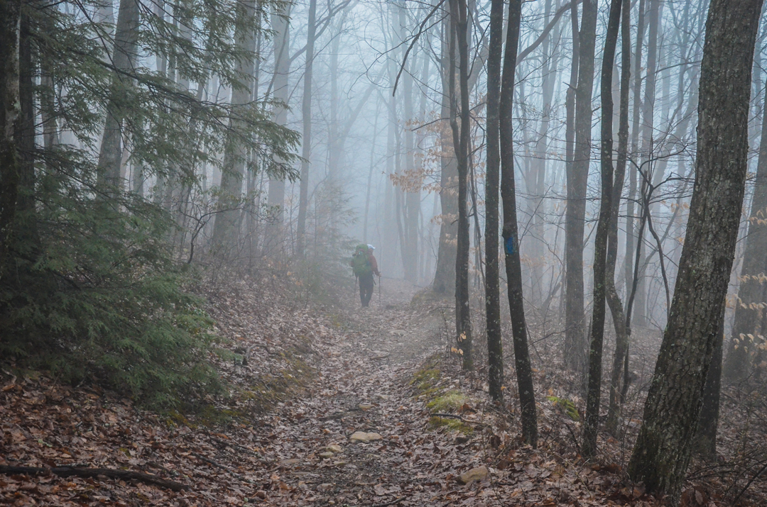
Photo by Coop
Our final hike was the same as our first, but in reverse. We followed the road to the trail, and followed it to the car where we arrived 37 minutes later.
TOTALS (30.74 MI | +5,710 GAIN | -5,605 LOSS)
FINAL THOUGHTS
What a trip! We set out to hike what Coop called the Iron Mountain Marathon and ended up finishing what we now call the Iron Mountain Ultra. It was our first (planned) four-day trip, first 30-miler, and it was the first time we hit double digits two days in row. While we hoped for snow, we’re glad it didn’t because snow would’ve forced us to decrease mileage and lessen our adventure by a day. We tested our orienteering skills thanks to the area’s myriad of interconnecting trails and roads, enhanced our fire-building abilities and learned what not to use, and we broadened our whistling playlist. The IMT challenged us both physically and mentally. It gave us spectacular views. And we got to take home some great memories.
Should you ever find yourself at Fairview with the intent of summiting Mt. Rogers, you should consider the other side of the road, and give Iron Mountain a shot. You won’t regret it.