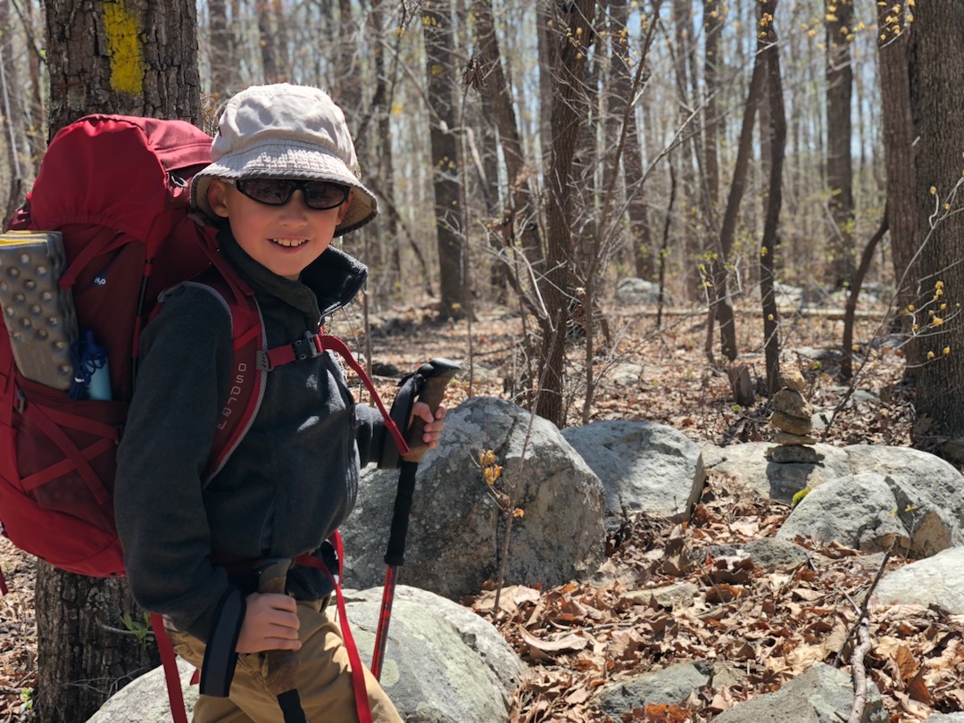
Backpacking Shenandoah National Park: Patches of Blue

trailhead sign for nicholson hollow trail
mountain view from an outcropping of rocks
Looking out from the Upper Falls off Whiteoak Canyon Trail
Photo by Coop

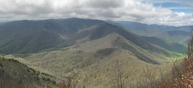
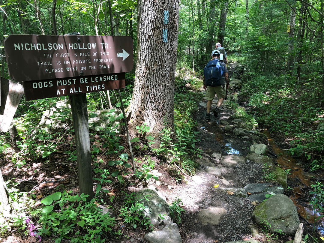
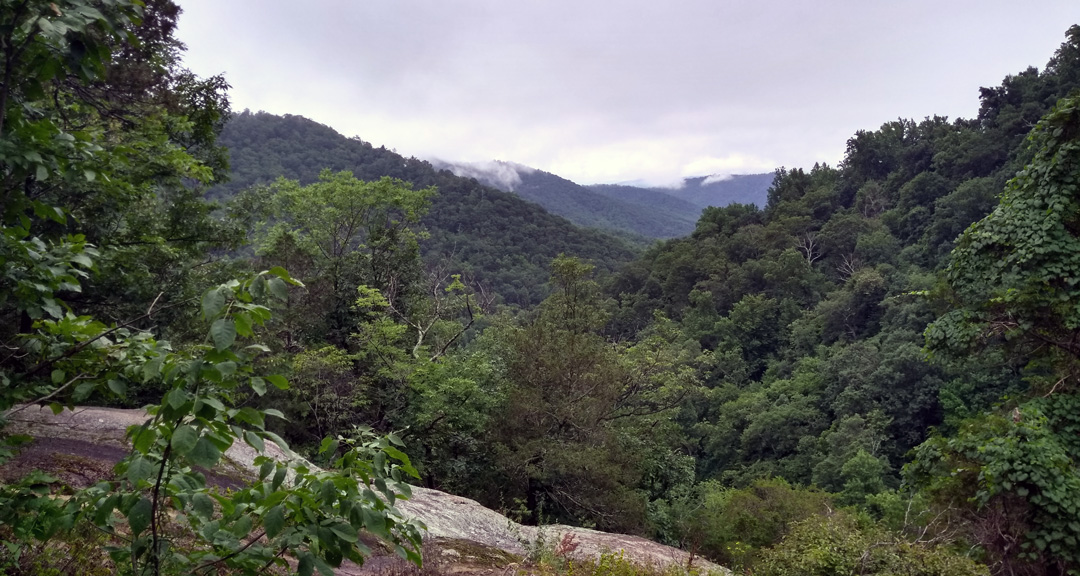
On our most recent trip to the Mt. Rogers National Recreation Area, my buddy, Coop, suggested we hit up Shenandoah National Park. Located 75 miles southwest of Washington, D.C., the park has 196,000 acres of backcountry and wilderness, over 500 miles of interconnected trails, a boatload of waterfalls, and is home to a great deal of wildlife including a pretty dense population of black bears.

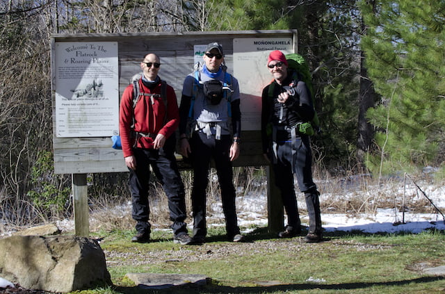
Upon returning home, we researched the area and asked around to see if anyone wanted to join us. A month later, we increased the party by one and narrowed our trip to the northern section of the park between Mary’s Rock, Stony Man, and Old Rag.

READ MORE

Backpacking Iron Mountain Trail: Crocodiles and Misdirection

Crocodile A-T checks the map
Photo by Coop

Backpacking in the winter can be a challenge due to the uncertainty that accompanies the cold season. However, if you’re willing to accept the risk, the rewards are incredible. For that reason, my buddy Coop and I make it a point to plan a yearly winter trip. More often than not, we find ourselves in the Mount Rogers National Recreation Area (NRA), a nearly 200,000 acre National Forest in southwestern Virginia. This year, Coop suggested we continue the trend and return to the NRA to tackle the northern section of the Iron Mountain Trail (IMT).

The yellow-blazed Iron Mountain Trail spans 47 miles from Highway 91 near Tennessee in the south to VA16 at Iron Mountain Gap in the north. Up until 1972, the IMT was part of the Appalachian Trail when it was relocated to the south to accommodate communication towers and power lines in order to maintain the secluded experience hikers have come to expect from the AT. The IMT is well-maintained thanks to local volunteers, has an old AT shelter in the northern section that’s in great condition, and as it turns out, is also the perfect location for our latest adventure.

READ MORE

Backpacking Dutchman’s Creek Loop: Wherever you go, there Uwharrie

trail sign that reads uwharrie trail
Trail sign at the northern Dutchman-Uwharrie junction

The Uwharrie National Forest (UNF) is a 51,000 acre forest system spanning three counties in south central North Carolina. It is one of the smallest national forests in the United States, and having been established in 1961, it is also the youngest of the four national parks in North Carolina. It has mountains, but the peaks have been worn down from 20,000′ millions of years ago to no more than 1,000′ today.

The forest offers a number of trails for hiking, mountain biking, horseback riding, and off-roading. There are lakes and rivers for fishing and water sports. Campgrounds for, uh, camping. What I’m trying to say is, there’s a lot of stuff to do there.

Well, for years my friends have talked about hiking in Uwharrie, but I’ve been wary to make the trip because 1) I tend to fancy the higher elevations, and 2) the forest is also a designated Game Land making it a popular destination for hunters and trappers. Well, I finally got over myself, and decided to give Uwharrie a chance.

READ MORE

Blue Ridge Relay 2017: Déjà vu all over again

post race team photo

The Blue Ridge Relay (BRR) is a really long Benny Hill episode where thousands of masochists abandon both sanity and dignity to run 208 miles from Grayson Highlands State Park in Virginia to Asheville, North Carolina. This year’s race hosted 194 teams of 4 to 12 runners who ran a total of 36 legs ranging from 2.5 to 10.5 miles per leg over the course of a day and a half.

That sounds awesome! How do I sign up? All you need is a group of people that won’t kill each other, a couple of vans, a roll of toilet paper, a llama, and a bag of pretzels. Get that stuff, get registered, and you’re ready to run the Blue Ridge Relay.

READ MORE

Backpacking Crawfish and Channel Rock Loop: Turtles and Butt Sweat

Lego backpacker
Lego backpacker
Lego backpacker isn’t a fan of summer hikes

Mount Rogers National Recreation Area (NRA) spans 191,000 acres in southwestern Virginia within the George Washington and Jefferson National Forests. The area has hundreds of miles of trails including 60 miles of the Appalachian Trail (AT) and boasts the highest peak in Virginia, Mt. Rogers at 5,729′.

I’ve been to the NRA three times: Beartree in Fall 2009, Grayson Highlands in Spring 2011, and Lewis Fork in Winter 2015. Having three of the four seasons covered it only made sense to find my way back for a summer trip.

With a general location set, I invited my brother-in-law, Ken, and my running buddy and first time backpacker, John, and started to prepare.

READ MORE

Backpacking the Cold Mountain Loop: Forecasts can’t be trusted

View from Cold Mountain Summit
Cold Mountain survey marker
Cold Mountain Summit

There’s a saying that if you’re backpacking and you don’t like the forecast, wait five minutes and it’ll change. That was certainly the case on a recent backpacking trip I took to the Shining Rock Wilderness with my brother-in-law, Ken. In the 10 days leading up to the trip we watched the wilderness area forecast change daily from hot to cold, sun to rain, and breezy to gale force winds.

In addition to the weather the Shining Rock Wilderness has a couple of rules that impacted our trip. First, no campfires. It’s a rule, and unfortunately many take it as a “rule” including the ones responsible for the recent fire at Cold Mountain that burned 132 acres. Second, in the past few years the bear population has increased resulting in greater than normal bear sightings and bear encounters (one backpacker had a bear enter his tent and remove his backpack). As a result, the U.S. Forest Service requires bear canisters in the Shining Rock Wilderness.

READ MORE

Backpacking Roaring Plains: April Snow and Swollen Creeks

Post-trip photo

I first read about the Roaring Plains Wilderness (RPW) when my buddy, Coop, and I were considering routes for our most recent winter trip to Dolly Sods. About a month after that trip, Coop invited me to join him and his brother-in-law, Craig, in the RPW for Craig’s first backpacking trip.

Located in the Allegheny Mountains of eastern West Virginia, the Roaring Plains Wilderness spans more than 12,000 acres of the Monongahela National Forest and is said to have the most vertical relief in WV. To get a better sense of the area Coop and I put together our Plan A using hillmap.com and the GPX from MidAtlanticHikes.com. The plan was simple: hike the 12.46 mile Roaring Plains Circuit, climb 2,560′, descend 2,566′, and drive to Amelia’s for breakfast when we finished.

Then came the wrenches.

READ MORE

Backpacking Dolly Sods Wilderness: Permits, mud, and the elusive goshawk

Sunset at our campsite at Left Fork Red Creek off Dobbin Grade (TR 526)
Photo by Coop

The Dolly Sods Wilderness is a rocky, high-altitude plateau in the Allegheny Mountains of eastern West Virginia and is part of the Monongahela National Forest. The wilderness has more than 47 miles of trails with elevations ranging from 2,500 to over 4,700 feet. If I didn’t have you at “Hello” allow me to share two other selling points that made the brochure: weather and explosives.

Weather in the Sods is as decisive as a two-year old. Snow can fall from October through April, freezing temperatures can occur at anytime of the year, and the winds can penetrate your soul. As for explosives, the area was used by the U.S. Army as a practice artillery and mortar range and maneuver area during World War II. And, while the National Forest Service and the Army Corps of Engineers did their best to remove Unexploded Ordnances (UXO) from the area there’s still a good chance some remain. Moral of the story: dress for every occasion and don’t touch the boom booms.

In spite of the potential to blow up, freeze, or both, the Sods really are a spectacular place to go. My buddy Coop and I rose to the challenge back in February 2014 when we hit the trails wearing snowshoes and a smile. This year we thought we’d give the Sods another shot and enlisted my brother-in-law, Ken.

READ MORE