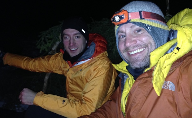
My buddy, Coop, and I have backpacked during the winter months for a few years now. Shining Rock in Western North Carolina, Roan Mountain along the Tennessee-North Carolina border, and most recently Dolly Sods in West Virginia.
We hadn’t traveled north for a winter hike, and it’d be a test for us as Dolly Sods is notorious for year-long crazy weather with an average annual snowfall of 55″. As he always does, Coop researched potential routes and came across White Grass Cross Country Ski Area, a cross country skiing and snowshoeing business in Davis, WV. He emailed Chip, the dude in charge, who kept Coop in the loop about weather and gear (including $15/day snowshoe rental).
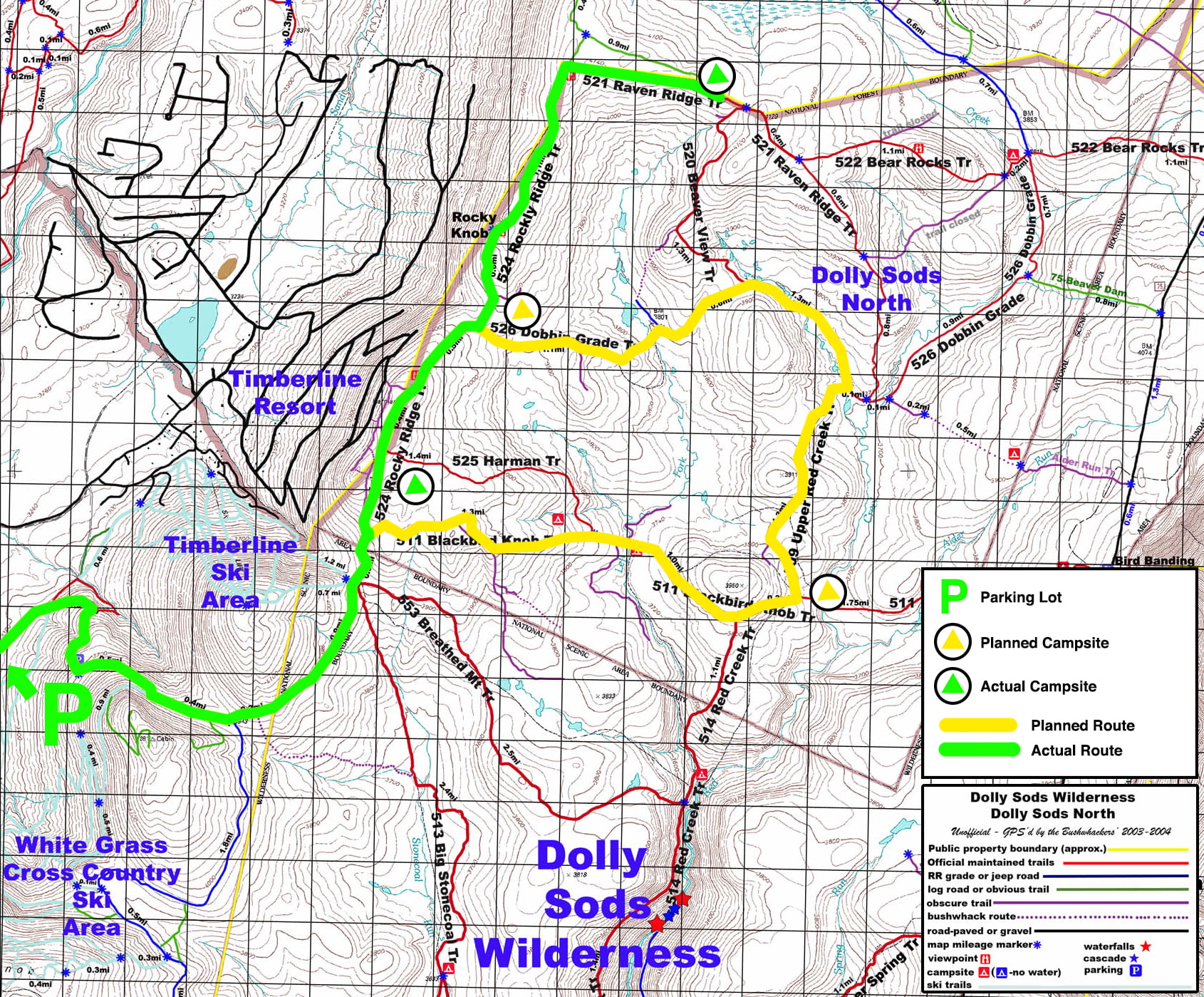
Our intent was to park at White Grass and take the Timberline trail to Forest Road 80 where we’d huff it up to 524 Rocky Ridge. From there we’d head east on 511 Blackbird Knob, camp at the intersection of Blackbird and Upper Red Creek, and then head up to Dobbin where we’d join up with Rocky Ridge which would take us back to our car. A fairly straightforward 3-day, 15.5 mile trip. However, thanks to the wintry weather, the actual route we hiked was a slightly different.
THE PLAN
Below is the trip as it was planned (yellow) and as it happened (green). For a larger view of the area check out the White Grass map.
DAY 1 (4.1 miles)
We arrived at White Grass at noon on Friday, rented snowshoes, and hit the trail. There was plenty of snow on the ground and the staff had said it was likely that the Sods would have more. We stuck with boots for the first 1.5 miles before switching to snowshoes as the snow got deeper. Holy cow! What a difference.
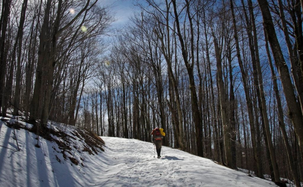
The next 1.7 miles was a seemingly never-ending uphill climb. Near the top, we stopped to read a sign warning of increased black bear activity in Western Sods. Thankfully, we were headed into the heart of the sods, and wouldn’t be spending much time in the western half.
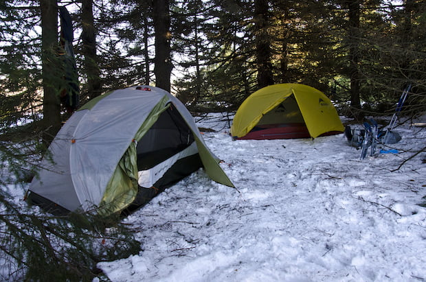
After joking about who would outrun who if a bear showed up, we got serious and sloshed through wet, melting snow which turned the trail into a knee-deep creek for the next half mile. At the Blackbird trailhead we turned east and began trouncing our way through slush and ice. Just down the trail was a pretty sweet campsite tucked into the trees just before the trail turned left. When it did, we were greeted by a creek. Uh, where’d the trail go?
Apparently, the amount of snow combined with the above-freezing temperatures created enough snowmelt to fill the usually dry creek bed that doubled as a trail (for most of the year anyway). This wouldn’t have been so bad if the trail/creek wasn’t surrounded by rhododendrons making it impossible to hug the shoulder. The more we walked, the more we questioned the route. All we could see was ankle- and knee-deep water. And while I had boots that kept the water out, Coop’s boots did not. So, with almost a mile to go before we hit the Harman-Blackbird intersection, we opted to turn around and take Rocky Ridge up along the western perimeter.
Yes, yes. I know. The bears. But 100% chance of frozen feet outweighed a slight chance for bears. We hit Rocky Ridge and another short uphill climb. The snow was heavy in some areas, but melted in others. Around 3:30PM we decided we’d hike for another half an hour and then set up camp. Around 3:32PM, we saw a patch of trees off to the right with a huge pile of firewood nearby. It was as though the gods of previous fires not started had taken pity on us. We cut our hike by 28 minutes, and made a B-line for our new home for the night.
There was an existing fire ring that we tightened up and surrounded with pine tree branches to keep the wind out. Ah yes, the wind. The forecast was for sub-freezing temps with 10-25 MPH winds and 50 MPH wind gusts. The forecast was spot on. Not because I had an anemometer handy, but because whenever the wind gusted we were nearly knocked to the ground.
Quick aside. Prior to becoming a designated Wilderness Area, Dolly Sods was target practice for the U.S. Army during World War II. As the story goes, they shot mortar rounds into the woods and not all of them exploded. Over the years, the Forest Service contracted with private firms to clear the trail corridors (500 feet on each side), but there are definitely more out there. Long story longer, don’t go off trail and don’t create new fire rings.
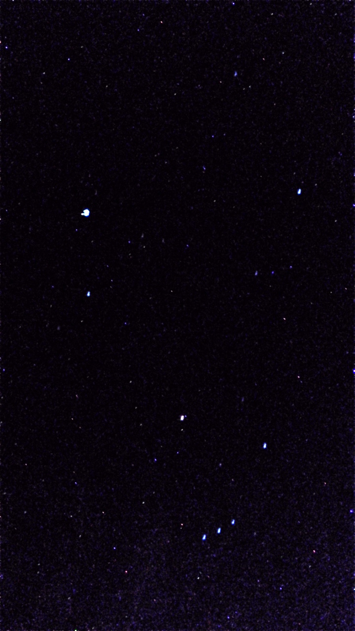
Once night fell, I broke out my portable grill grate and Coop cooked up brats and kabobs. After dinner, we broke out the S’mores. I know, I can hear you saying, “WTF? S’mores, too?” The weight of carrying two bars of chocolate, a pack of crackers, and a handful of marshmallows pales in comparison to the gloriousness of eating a S’more or two or three. We closed out the night watching the stars fill the sky and enjoying a couple of cigars.
Before bed we grabbed water from a melting creek, examined bear and deer poop, spotted four deer at the south end of the field, and then hung our food downwind of our camp.
DAY 2 (2.6 miles)
Over dinner we talked about taking Rocky Ridge up to Raven Ridge and setting up camp near Beaver View. In the morning, we ate breakfast, broke camp, and headed out on the trail. About a mile and a quarter in, the trail went missing. Since it’s a wilderness area there aren’t any blazes, but hikers before us built cairns (rocks stacked on top of each other). Well, we couldn’t find any cairns, so we broke out the map and compass. Since we were still headed north/northeast and we saw what appeared to be Rocky Knob off in the distance, we figured we were headed in the right direction.
A half mile later we came across Rocky Knob and found the trail again. Once past the knob it was pretty much all ridgeline to Raven Ridge with the exception of a small downhill. Once we hit Raven Ridge Trail, private property signs marked the boundary line between the land to the north of Dolly Sods and the trail.
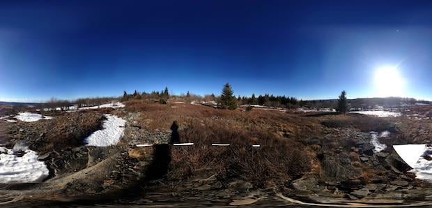
Following the trail we hit a bald which led to a valley which led to a bald where we found a patch of woods we’d use to keep ourselves out of the elements. The forecast called for strong winds and a 30% chance of 1″ to 3″ of snow after midnight.
With plenty of light left in the day, we set up camp, gathered wood, filled water from the valley below, and shot the breeze for a while.
As night fell we re-hydrated our dinner, ate more S’mores, and smoked a couple more cigars. All that was followed by chit-chat, stargazing, and hanging of our food high in a tree, downwind from our campsite.
DAY 3 (6.7 miles)
Our last day was simple. Break early and head for the car. We woke at 7AM, ate, broke camp, and were on the trail at 8:10AM. The good news, no new snow and beautiful blue skies. The bad news, we had a 6.7 mile hike and a several hour drive before we’d be resting in our own beds.
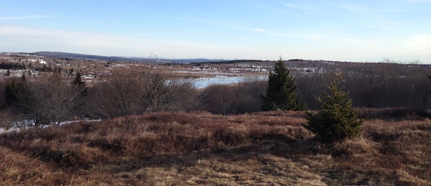
With this in mind, we started hauling arse. We were way ahead of our anticipated 5-hour mark, so we stopped to take photos at the bald on Raven Ridge overlooking the Dobbins Slashing Bog below and the wind farms in the distance. As we continued towards Rocky Ridge Trail, we came upon fresh tracks from a hiker we hadn’t seen. It appeared that the hiker had made it to the bald and turned around. To this point, we hadn’t seen any evidence of hikers anywhere on the trail.
Back on Rocky Ridge, we came across two piles of wildcat poop within 5 feet of one another (the second was filled with pretty large bones). That’s when we started seeing big cat tracks. Like, 3.5″-4″ big. I’m no tracker, but comparing what we saw to an online identification guide, I’m guessing the tracks were either a mountain lion or a really big bobcat.
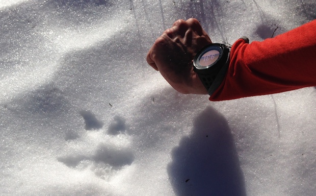
The tracks were going in the same direction as we were and continued on past Rocky Knob; eventually disappearing just after the Harman Trail intersection. That’s when we went from looking down to looking up. We didn’t see anything in the trees, but we figured (hoped) that the cat was long gone.
As we walked passed Harman Trail, the snow had melted significantly since the previous day. And, thanks to the early morning freezing temperatures, the leftover snow and slush had frozen over making it a boatload easier to walk. So easy that when we hit Breathed Mountain Trail we had a mere 3.3 miles to go. At our current rate that meant about 80 minutes. The last bit of the trail required hiking a long uphill to the forest road and then a long downhill to Timberline. Sure enough, 80 minutes later (and 3 hours to the second from when we broke camp) we arrived at our car.
FINAL THOUGHTS
We hiked a total of 13.4 miles over 3 days. We started at White Grass Cross Country Ski Area, followed Timberline to Forest Road 80, to Rocky Ridge and camped just shy of the Harman Trail intersection (4.1 miles). We then continued on Rocky Ridge to Raven Ridge and camped just shy of Beaver View Trail (2.6 miles). The final day we simply hiked back to the car taking Raven Ridge to Rocky Ridge to Forest Road 80 and eventually to the Timberline Trail (6.7 miles).
If you’re interested in learning more about the Dolly Sods area I suggest checking out the Forest Service Dolly Sods webpage. And if you’re thinking of hiking the Sods in the winter you better wear snowshoes, and you most definitely need to bring S’mores.